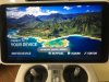
If I open the 'Here' maps window in DJI GO 4 and select an area while connected to WiFi the street map layer seems to download and cache locally as they should (for the entire area selected), however the satellite layer will not seem to cache unless you actually drill down to maximum detail on each panel... kind of a PITA. Is this expected behavior or am I doing something wrong?


You are using an out of date browser. It may not display this or other websites correctly.
You should upgrade or use an alternative browser.
You should upgrade or use an alternative browser.
Downloading maps offline
- Thread starter smiller
- Start date
msinger
Approved Vendor
- Joined
- Oct 30, 2014
- Messages
- 32,182
- Reaction score
- 10,931
- Location
- Harrisburg, PA (US)
- Website
- phantomhelp.com
Yes -- you should zoom down to the zoom level you'll be flying at before scrolling around to download and cache the map images.
msinger
Approved Vendor
- Joined
- Oct 30, 2014
- Messages
- 32,182
- Reaction score
- 10,931
- Location
- Harrisburg, PA (US)
- Website
- phantomhelp.com
That's definitely one of the cons of using the P4P+ screen.if I plan on working in a large area that process is kind of laborious
Well in most cases I would simply be tethered to my phone with the P4P+, so no difference between that and using a phone/tablet as a display. The reason I would need to download would be if I was in an area outside of cellular range, in which case I would have to download the maps in advance even if I was using a separate device, so again, no difference.That's definitely one of the cons of using the P4P+ screen.
msinger
Approved Vendor
- Joined
- Oct 30, 2014
- Messages
- 32,182
- Reaction score
- 10,931
- Location
- Harrisburg, PA (US)
- Website
- phantomhelp.com
You can tether to your phone while you're flying?Well in most cases I would simply be tethered to my phone with the P4P+
Sure, the DJI GO 4 app on the P4P+ is running under Android just like a phone/tablet and if there is WiFi available (from a tethered phone) then Internet access is transparent, just like on a phone. DJI GO doesn't know the difference either way.You can tether to your phone while you're flying?
Last edited:
msinger
Approved Vendor
- Joined
- Oct 30, 2014
- Messages
- 32,182
- Reaction score
- 10,931
- Location
- Harrisburg, PA (US)
- Website
- phantomhelp.com
Got it. I thought I saw DJI support saying the screen connected to the RC via Wi-Fi over in RCGroups.
Yeah, the screen (actually a small self-contained Android tablet, as with CrystalSky) is connected to the RC via USB, just like any other device. And the screen (and the DJI GO running on it) connects to the world via WiFi, just as an external tablet would. There's essentially no functional difference between the two as far as I can tell, just think of the P4P+ screen as any other tablet or phone (although with several enhancements/optimizations for flight use of course.)
Last edited:
Yeah, I do a lot of my flying in the outback sections of Utah and the southwest so I'm often in places with no hint of cellular service. What would be nice is a feature to define a box on the map so that the satellite data for that box is downloaded down to the finest level. Even better if you could move the corners to make a more complicated shape like a trapezoid.
Brian
Brian
It seems to work like that for the street map layer (using the dimensions of the screen for the boundaries -- although I'd have to check again to be sure about that), but not for the satellite layer. I wouldn't be surprised if it works that way for Google offline maps too, the satellite imagary would probably result in a huge file if auto-downloaded... they want you to work for it.Yeah, I do a lot of my flying in the outback sections of Utah and the southwest so I'm often in places with no hint of cellular service. What would be nice is a feature to define a box on the map so that the satellite data for that box is downloaded down to the finest level.
")
- Joined
- May 19, 2017
- Messages
- 3
- Reaction score
- 0
- Age
- 44
- Joined
- Apr 7, 2017
- Messages
- 18
- Reaction score
- 0
- Age
- 60
I am having the same problem. Even with full wifi sitting next to my router no maps.Just got a P4P+ and have no clue why I can't download the maps onto the controller.
If I enable mainland china it shows me those maps to down load but nothing in America.
If you figure it out please let me know
- Joined
- Jun 15, 2017
- Messages
- 2
- Reaction score
- 2
- Age
- 57
Same thing. After most recent firmware upgrade, only China offline maps available, and Chinese symbols on map page. Reset to factory default, and everything is back, including previously downloaded offline map. Upon reset, it will ask you to sign in to DJI GO, and WiFi will be off, so you will need to know how to go into settings to set up WiFi first, by swiping down on the screen from top.
- Joined
- Apr 7, 2017
- Messages
- 18
- Reaction score
- 0
- Age
- 60
- Joined
- Apr 7, 2017
- Messages
- 18
- Reaction score
- 0
- Age
- 60
Did you ever solve??Need help. Here also... 1 month ago and for the last 6 months I had maps.. now nothing.. still see my route and home and can steer back home. But NO maps... and the only maps it shows to down load are in China... [emoji12]
- Joined
- Apr 7, 2017
- Messages
- 18
- Reaction score
- 0
- Age
- 60

Similar threads
- Replies
- 3
- Views
- 4K
- Replies
- 31
- Views
- 9K
- Replies
- 4
- Views
- 2K


