thanks a lot, i will give it a try. I am desperate to find a solution to this unfortunate situation. To me it looks like a bad programming by DJI to limit ATTI flights to such low attitude.This app works good! You can set the angle above horizon limit and get a better idea of what GPS coverage will be.
View attachment 111474


You are using an out of date browser. It may not display this or other websites correctly.
You should upgrade or use an alternative browser.
You should upgrade or use an alternative browser.
you are right, but when there is more satellites around, chances are that i may easier get a gps signal. it is not easy to get to that location. First it is 2 hrs drive, and then tough hike, often through mountain river bed, getting wet, with drone in dry bag, etc. - so i try to minimize failure trips like my last one...That wouldn't be much help because there are always plenty of satellites in your sky.
The problem is you are at the bottom of a deep, narrow canyon and the terrain blocks the view of most of the sky, leaving only a small slice visible.
Your Phantom can only receive signal from the sats that are visible to it.
unfortunately this won't work. it is for a very high end film production and they clearly described they need a smooth clip of drone going from bottom up to top of the fall, no joining clips.Maybe possible to get what you can from the bottom and then fly from the top to get some more allowing you to piece it together. Not ideal but might get you the footage you need.
Will need to discuss it with them. Why DJI did set such low limit for ATTII flights eludes me.
the answer is in my original post. ATTI does not allow me to fly high enouigh. I think it is a valid reason, ha ha...So you don't like the suggestion just to use ATTI mode? Any reason for that?
Meta4
Premium Pilot
- Joined
- Jan 8, 2014
- Messages
- 15,388
- Reaction score
- 9,341
There are always plenty of satellites in the sky, anywhere in the world, any time.you are right, but when there is more satellites around, chances are that i may easier get a gps signal.
No time will be better than any other time.
If you have 75% of the sky blocked by canyon walls, you've blocked approx 75% of the satellites.
The actual situation would possibly be worse because what sats your antenna can see are likely to be bunched up and may not give a suitable spread for a good fix.
the answer is in my original post. ATTI does not allow me to fly high enouigh. I think it is a valid reason, ha ha...
Agreed. Having looked into it, there does seem to be a height limitation when the GPS signal is poor, independent of the flight mode. That's definitely a problem. There is a fix however, at least for some firmware versions. If you use DJI Assistant 2 v 1.1.2 in debug mode, you can change the parameter that controls this which, depending on aircraft model and firmware, should look something like this:
g_config_flying_limit_limit_height_abs_without_gps
There are always plenty of satellites in the sky, anywhere in the world, any time.
No time will be better than any other time.
If you have 75% of the sky blocked by canyon walls, you've blocked approx 75% of the satellites.
The actual situation would possibly be worse because what sats your antenna can see are likely to be bunched up and may not give a suitable spread for a good fix.
Agreed - that's probably not going to work because, even if more satellites appeared in the limited area of sky view available, the hDOP is going to be poor and so the navHealth value is going to be low, which is what triggers the height limit.
Thanks so much. This could be the solution, i will check this. Most appreciated!Agreed. Having looked into it, there does seem to be a height limitation when the GPS signal is poor, independent of the flight mode. That's definitely a problem. There is a fix however, at least for some firmware versions. If you use DJI Assistant 2 v 1.1.2 in debug mode, you can change the parameter that controls this which, depending on aircraft model and firmware, should look something like this:
g_config_flying_limit_limit_height_abs_without_gps

makes sense. Just an unfortunate location to film. and i somehow need to deal with it.Agreed - that's probably not going to work because, even if more satellites appeared in the limited area of sky view available, the hDOP is going to be poor and so the navHealth value is going to be low, which is what triggers the height limit.
Novice suggestion:
rent a (maybe higher end) drone that DOESN'T have this problem...?
(charge that rental fee to those paying for filming)
rent a (maybe higher end) drone that DOESN'T have this problem...?
(charge that rental fee to those paying for filming)
- Joined
- May 11, 2018
- Messages
- 72
- Reaction score
- 49
- Age
- 69
I would certainly give Litchi a try in these circumstances. Even if you don't need to program a flight, flying manually using Litchi might get around your problem. It seems like Litchi does not have the problems with certain restrictions like the dji Go app does. Every time I start up the dji Go app it asks me if I want to update the 'fly safe' database and I just click on ignore. The Litchi app never gives me that stuff. Unfortunately, I don't know if this work around will work as I have never encountered your situation.
I would certainly give Litchi a try in these circumstances. Even if you don't need to program a flight, flying manually using Litchi might get around your problem. It seems like Litchi does not have the problems with certain restrictions like the dji Go app does. Every time I start up the dji Go app it asks me if I want to update the 'fly safe' database and I just click on ignore. The Litchi app never gives me that stuff. Unfortunately, I don't know if this work around will work as I have never encountered your situation.
The height restriction with poor hDOP or few satellites is in the aircraft firmware, not imposed by the app.
good suggestion, and i would consider it - if not for the fact that i am on a tiny caribbean island, and shipping things here is a nightmare, so it would be the last resort. But yes, possibly inspire would do better. thanks!Novice suggestion:
rent a (maybe higher end) drone that DOESN'T have this problem...?
(charge that rental fee to those paying for filming)
Might not be a bad idea. I almost lost a job this week because I couldn't take off. It was an unlockable zone and I did everything I was supposed to on the DJI GEO unlocking site and got the OK. But, it didn't show up on the DJI Go app once in the area. I also tried while on site using my phone as a hot spot to have an internet connection to my iPad. Still, nothing on the unlocking zones in the app.
Luckily, I zoomed in on the area a saw that I was just a half block from getting out of the zone. I moved 100' away and was able to complete my job.
Luckily, I zoomed in on the area a saw that I was just a half block from getting out of the zone. I moved 100' away and was able to complete my job.
Hi Holoboss, I fly P3 Advanced and have no experience of P4, but in the P3 you can select up to 3 satellite constellations (GPS, Glonass, Galileo) I think, so perhaps check to see how many you have got selected (if you can do that in the P4) and it might just give you a greater number of satellites available while you are down amongst the terrain? However, I acknowledge what was said earlier by sar104 as the geometry may still not be sufficiently strong for good location.
Meta4
Premium Pilot
- Joined
- Jan 8, 2014
- Messages
- 15,388
- Reaction score
- 9,341
An Inspire 2 is programmed exactly the same way.good suggestion, and i would consider it - if not for the fact that i am on a tiny caribbean island, and shipping things here is a nightmare, so it would be the last resort. But yes, possibly inspire would do better. thanks!
From the Inspire 2 manual:
Height is restricted to 26 feet (8 meters) when the GPS signal is weak and Vision Positioning is activated. Height is restricted to 164 feet (50 meters) when the GPS signal is weak and Vision Positioning is inactivated
No DJI drone uses Galileo and there's no way to select or deselect satellite types.Hi Holoboss, I fly P3 Advanced and have no experience of P4, but in the P3 you can select up to 3 satellite constellations (GPS, Glonass, Galileo) I think, so perhaps check to see how many you have got selected (if you can do that in the P4)
When his GPS receiver has most of the sky blocked and only sees a small slice of sky, multiple satellite types won't make any difference.and it might just give you a greater number of satellites available while you are down amongst the terrain? However, I acknowledge what was said earlier by sar104 as the geometry may still not be sufficiently strong for good location.
Last edited:
this is not enough height to catch gps easily. it may, or may not. it is like in deep canyon i would need to go higher. will have to test, no other choice.
I remember couple of years ago someone showed me a site which was like schedule of satellites. one could look how many satellites will be in your area tomorrow morning, by hour. and then you see number of satellites changes all the time, like sea tide. I can't find that site any more, but it would help me to go there when there is more satellites around me. Do you know of such resource by any chance?
Many thanks
Derek
This the one??
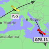
Live World Map of Satellite Positions
A world map of the positions of satellites above the Earth's surface, and a planetarium view showing where they appear in the night sky.
in-the-sky.org
Similar threads
- Replies
- 3
- Views
- 51K
- Replies
- 14
- Views
- 7K
- Replies
- 15
- Views
- 11K


Recent Posts
-
-
 North Jersey, Very new old guy trying to get off the ground with a P330Z Phantom 2
- Latest: captainmilehigh
-

-
