

Each day, I shoot the same sequence of stills and video along this stretch of central Arizona's Verde River. These images will be used to test a new technique of monitoring changes in the River's flows and the health of its ecosystem.
Since it's important to get as complete a record as possible, I sometimes press the limits of good sense, as far as the safety of the aircraft is concerned.
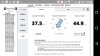
On this day, April 25th, 2016, high winds threatened to make the day's record impossible, but I thought I'd try. Winds at the aircraft's altitude, according to mesurements on "Healthy Drones," hovered around 38 mph, sustained. The flight is programmed using Litchi, to fly this route at 30 mph, and you can see that the drone had a tough time maintaining that speed.
But the Phantom 3 did an amazing job of stabilizing the video in incredibly tough circumstances, don't you think?! See the video at:
Since it's important to get as complete a record as possible, I sometimes press the limits of good sense, as far as the safety of the aircraft is concerned.
On this day, April 25th, 2016, high winds threatened to make the day's record impossible, but I thought I'd try. Winds at the aircraft's altitude, according to mesurements on "Healthy Drones," hovered around 38 mph, sustained. The flight is programmed using Litchi, to fly this route at 30 mph, and you can see that the drone had a tough time maintaining that speed.
But the Phantom 3 did an amazing job of stabilizing the video in incredibly tough circumstances, don't you think?! See the video at:


")
")


