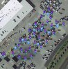
.DAT file interpretation

Joined
Jun 7, 2018
Messages
8
Reaction score
1
Age
28
Hello,

I am a recent owner of a standard P3. I have flown it quite a few times both manually and using Litchi's waypoint mission. The other day a weird thing happened, I was flying a waypoint mission using Litchi and I lost sight of the drone for a few minutes, I got a disconnected warning from the app and the drone veered off course and crashed into a building wall. I pulled the .DAT file off the aircraft and I'm trying to use CSV View in order to understand why it crashed. I cannot understand what the data means and I would really like to know why this happened as I've flown the same site multiple times with both waypoint and manual modes and nothing of that nature happened. Please help me understand why the drone crashed in order to prevent this from happening again. Kindly find the file in the google drive link below as its too big to attach to the thread.

FLY015.DAT

Thank you!
 
As a quick initial look without going in to too much detail as of yet. It appears that you lost GPS momentarily and the aircraft switched out of NAVI mission mode and back to GPS-ATTI. There is no RC disconnect in this file so you should have had full control via the RC. Will look in more detail when I get the chance to do so.
 
If this is the flight in question, it certainly looks like you had GPS issues. In the GE photo below, notice basically solid yellow line before the red arrow. These vertical line's are each reported GPS position for the entire flight, per the .dat file you posted. Notice after the red arrow these vertical lines become few and far between which says that the GPS reporting was intermittent during that portion of the flight. As to why this is I can't say as of yet, but that is what I am seeing.

GPS POINTS2 copy.png
 
  • Like
Reactions: BudWalker
Ok, if you wish to go further with this analysis, more information is needed. Describe what you did. There is some odd data in this file.
 
Thank you Fly Dawg. I really appreciate it! So the weird thing is, the drone never made it to the right side of the thick yellow line where the arrow points. Once it got to that point, it veered left and slammed into the hangar wall. The battery fell out and I took the drone straight back inside. Im pretty sure this is the flight, both the date/time stamp and the flight path support that this is the flight in question.

What happened is this: I manually took off with the aircraft. Once it was at a stable height, I loaded the waypoint mission using Litchi and the drone automatically went to waypoint 1 and started its path. On its way from waypoint 1 to waypoint 2 I lost sight of the drone. I was monitoring the app, and a little bit after reaching waypoint two, I could see the drone veering to the left, and as soon as that started happening I got an audible: " Warning: Disconnected " message, im not entirely sure if it was the remote or the Litchi app. I tried using the joysticks to control the drone but I didnt have control. At this point, I still cant see the drone, so i run to a spot where I can see it and as I'm running over there, I try switching S1 hoping to gain control but I'm thinking it was too late as when I got to the spot to see the drone, it had already crashed into the wall and was falling down. The battery fell out and was damaged pretty bad. The drone only suffered cosmetic damage and two of the pins holding the gimbal fell out so I replaced them and the battery. I automatically took the drone inside with the battery out. It never moved to the right of that point as it was only on waypoint 2 when that happened. I attached a screenshot of the waypoint mission from mission hub in order to help visualize.

If I indeed lost GPS connection, Firstly, why did I loose GPS connection? and what should have happened? and more importantly, what should I have done?

Im hoping to be able to learn as much as I can from this crash in order to become a better pilot and hopefully be able to avoid future crashes.

Thanks again!
 

Attachments

  • Run 2 Waypoint Mission.JPG
    Run 2 Waypoint Mission.JPG
    368.6 KB · Views: 201
If this is the flight in question, it certainly looks like you had GPS issues. In the GE photo below, notice basically solid yellow line before the red arrow. These vertical line's are each reported GPS position for the entire flight, per the .dat file you posted. Notice after the red arrow these vertical lines become few and far between which says that the GPS reporting was intermittent during that portion of the flight. As to why this is I can't say as of yet, but that is what I am seeing.

View attachment 101376
Let me just add that it appears the GPS receiver didn't disconnect or go intermittent. Looking at the GPS:time signal it cab be seen there were no gaps in the interval immediately preceding the jumps.
upload_2018-7-18_6-36-1.png

The AC was here
upload_2018-7-18_6-36-28.png

A little before the jumps there was an increase in the GPS Dilution Of Precision and then drop in gpsHealth.
upload_2018-7-18_6-39-37.png


Why did all this happen? Don't have a clue.
 

Attachments

  • upload_2018-7-18_6-36-12.png
    upload_2018-7-18_6-36-12.png
    13.3 KB · Views: 254
Hmm im not sure either. Well either way, what do you suggest I do in case anything like this happens? From your experience, can you give me a few rules/tips to do in case of emergencies like this in order to prevent a crash. I guess most common tips to avoid a crash.

Thanks again
 
If this is the flight in question, it certainly looks like you had GPS issues. In the GE photo below, notice basically solid yellow line before the red arrow. These vertical line's are each reported GPS position for the entire flight, per the .dat file you posted. Notice after the red arrow these vertical lines become few and far between which says that the GPS reporting was intermittent during that portion of the flight. As to why this is I can't say as of yet, but that is what I am seeing.

View attachment 101376
Question, is the solid yellow line something you filled in or that what it is suppose to look like?
Would a whole flight normally be solid?

@lhanania
Can you share your mission from the hub, the mission not a picture?

Rod
 
Question, is the solid yellow line something you filled in or that what it is suppose to look like?
Would a whole flight normally be solid?
No. The solid line is not actually solid. It is reported GPS points from the logs. The more solid the line. The more GPS points that are reported. When the line is seperated and not equal in separation. The GPS points are reported far and in between. This was from the actual positioning file that was provided.
 
This is actually from the data, the yellow line, solid or not you didn't modify for the post?

If the Phantom had good satellite signal through the entire flight it could actually be just as solid as in your post?

Rod
 
This is actually from the data, the yellow line, solid or not you didn't modify for the post?

No. That is from the actual data. An easier way to think of it would be like a fence. The "solid" yellow line may have a fence post every 2 feet. Which at the altitude you are looking at on GE would make the line appear solid. After that you can tell by the image that the "fence" posts are now far away from each other and random.
 
@RodPad ....This is a closer view of the "solid" line, to show it is not actually solid.

Close Up.PNG
 
Got it!
That's what I was looking for!

So, I guess the question that I have and maybe you and Bud also, why the trail after the crash, did he insert the battery or another power it on, while he was carrying it?

Rod.
 
why the trail after the crash, did he insert the battery or another power it on, while he was carrying it?
I have read the OP's statements and looked at this. But do not want to oppose the OP's statements. First this would not be possible that I know of and be recorded in the same .dat file. The aircraft starts a new .dat at each power on, flight or no flight. I did not see any power downs.
 
  • Like
Reactions: RodPad
If this is the flight in question, it certainly looks like you had GPS issues. In the GE photo below, notice basically solid yellow line before the red arrow. These vertical line's are each reported GPS position for the entire flight, per the .dat file you posted. Notice after the red arrow these vertical lines become few and far between which says that the GPS reporting was intermittent during that portion of the flight. As to why this is I can't say as of yet, but that is what I am seeing.

View attachment 101376
There is an important distinction to be made here. It's not that GPS started missing some of it's reports. Rather, the GPS continued reporting at the same rate but the coords were incorrect. The jump from end of the arrow to next to the hangars isn't physical - it didn't actually happen.

I was tempted to think that being in the vicinity of the hangars caused the increase in Dilution Of Precision which, in turn, caused the incorrect coords. But, that's nonsense since DOP is dependent only satellite position.

But, maybe reflections of the hangars caused some jitter and reduction in signal-to-noise ratio for some of the sats. I looked through the sat SNRs and picked some that seem to show this. Time 69.42 secs corresponds to the beginning of the first jump.

upload_2018-7-19_6-6-44.png


To be sure there were several such SNR drops by the individual sats over the flight. But, several seemed to occur at 69.42 secs
upload_2018-7-19_6-10-35.png


BTW, the sat SNR sigs are experimental. To see them CsvView has to be told to present them.
upload_2018-7-19_6-12-35.png
 
  • Like
Reactions: Dronason and RodPad
There is an important distinction to be made here. It's not that GPS started missing some of it's reports. Rather, the GPS continued reporting at the same rate but the coords were incorrect.
So, what you are describing here is basically "Noise" interference that caused the GPS coord's to be incorrect? I understand SNR somewhat, so this means the "noise" levels exceeded the GPS signal levels for individual sat's at certain points, causing the incorrect co-ordinances to be reported, am I describing this correctly? My question would be, where did the "noise" originate?
 
So, what you are describing here is basically "Noise" interference that caused the GPS coord's to be incorrect? I understand SNR somewhat, so this means the "noise" levels exceeded the GPS signal levels for individual sat's at certain points, causing the incorrect co-ordinances to be reported, am I describing this correctly? My question would be, where did the "noise" originate?
I'm supposing the noise is the form of jitter - which is actually a technical term. The sat signal bounces off a hangar which causes two signals to arrive at the GPS receiver. The bounced signal has a longer path and arrives a little behind the direct non-bounced signal. The signals are just a stream of bits, each being on or off for a certain length of time. The problem is that the beginning (or end) of a bit can be compromised by the longer path bounced signal. It's called jitter because the transition between two different bits won't be clean - it'll go back and forth before finally settling on the real value.

This might be a bit more informative
Jitter - Wikipedia
 
I'm supposing the noise is the form of jitter - which is actually a technical term.
I'm familiar with jitter as well. I have just considered it as a form of "noise", but more digital related than analog as you mentioned in relation to the bit's. I would assume that these are LSB's, but that would probably be difficult if not impossible to determine which. Although there is an analog form of "jitter" in relation to signals. I see where you are coming from. Not being that familiar with the GPS receiver profile ( physically and design wise speaking) I couldn't even guess where the reflected signal would interfere, but evidently it is a distinct possibility.
 
I'm familiar with jitter as well. I have just considered it as a form of "noise", but more digital related than analog as you mentioned in relation to the bit's. I would assume that these are LSB's, but that would probably be difficult if not impossible to determine which. Although there is an analog form of "jitter" in relation to signals. I see where you are coming from. Not being that familiar with the GPS receiver profile ( physically and design wise speaking) I couldn't even guess where the reflected signal would interfere, but evidently it is a distinct possibility.
Yeah, I know just enough to suggest this may be happening. Maybe someone will come along who actually knows if this is a plausible explanation.
 
So i guess incorrect coordinates are the reason this happened due to the GPS signal bouncing of the hangars and going back to the receiver? I guess the only way to solve that is to not fly by the hangers :p

Also, I tried flying the same waypoint mission at a slightly lower altitude today and I was following the drone with a golf cart. The same thing happened as in the drone started veering in random directions. An audible low GPS satellite number (or something of that nature) sounded from the app/RC. Since I was able to see the drone this time, I switched S1 to its forward position and took control of the aircraft and landed it safely. The DJI's log file, Litchi's log file, and the waypoint mission are shared on the google drive link below. Let me know what you guys think. I actually have two Litchi log files uploaded as I'm not sure which one it is. They are both around the same time. After I landed the aircraft safely, I tried flying it in manual mode but it was very unstable so I landed and turned it off. Maybe thats why I have two files on Litchi's logs.

I'm just trying to get to the bottom of this. If it is actually interference and signal bouncing, why does it not happen every time I fly the drone. I flew the same mission multiple times and it worked perfectly.

Drone Data - Google Drive

Thanks again guys, I really appreciate all your help.
 

Recent Posts

Members online

No members online now.

Forum statistics

Threads
143,087
Messages
1,467,528
Members
104,965
Latest member
cokersean20