Release DJI Ground Station for P2V Waypoints app 1.0.41

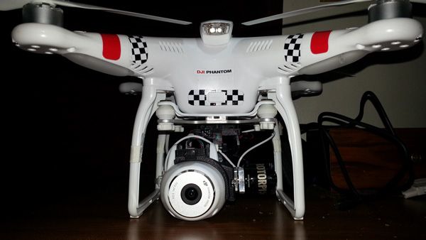
98 feet may be a bit to low.. Depending on the area you're flying in. I have Pine Trees that reach 90 feet so i set my altitude at 130 to 150. Keep in mind your first waypoint needs to be directly overhead as this craft will slowly climb out to its first waypoint.

Its also unsettling once its away and i lose wifi and TX control... At that point its fully autonomous, and you just have to trust the technology... I've called my Vision home a few times already, unsure if it was still on its route.
When you fly above heavily treed areas... Its scary to trust it to perform as advertized.
 
ta. yeah, when i did my one go at it, i was very worried...acutely listening out for the returning humm. a relief when it came
 
It's a simple matter to measure the tree's height BEFORE flying autonomously.

In fact, I can't think of an easier way to measure a tree's height than using a quadracopter.
 
Ground Station

I updated the firmware and the app.
The app fails to connect.
Am I missing something here.
Is there anything additional needed.
Thanks

I think I answered my own question.
Guess Ground Station is a separate linking system.
Didn't realize that. Now see on the site where it mentions Ground Station "Support".
 
Mori55 said:
Let us know how theyre mounted.


I cut the rubber housing away as much as possible. Used some white Velcro and mounted it right on top/center all the way forward. I checked and still got 11 satellites locked so I don't think its enough to block any reception.

Test it on the 4th during fireworks. :cool:
Mini-strobe01.jpg

Mini-strobe02.jpg


The Rookie
 
I'm going to take a look at a building this afternoon. I want photos and video. WIll it work if I do this?
1 setup waypoints to fly back and forward over the target twice.
2 first run have video recording.
3 pause at the end of the first run.
4 switch to interval photos and then press the start button and let it do its second run

or will changing from video to photos cancel the waypoints?
Any other suggestions on this plan?
thanks
 
John Shaw said:
I can see setting up a route to easily get the phantom to a certain position much more easily than flying it there,
pause it,
take over manually to take your pictures or video,
use HL to return it overhead, etc

And this is just a basic example. Set up next location after first pics are taken etc.
.

Agree, that's a useful and intelligent use for it - rather than just performing a circuit like a stunt really.
 
RCRookie said:
Mori55 said:
Let us know how theyre mounted.


I cut the rubber housing away as much as possible. Used some white Velcro and mounted it right on top/center all the way forward. I checked and still got 11 satellites locked so I don't think its enough to block any reception.

Test it on the 4th during fireworks. :cool:
Mini-strobe01.jpg

Mini-strobe02.jpg


The Rookie

How much of a job was it to cut out the housing? Did it come out fairly clean?

Tanx...
-slinger
 
Ground station for iPad without hardware?

Hi,

Just to double check the Ground station for iPad need a additional hardware and can't work with an Phantom 2 vision without that hardware ?
I know the ground station mode is working on iPhone with DJI.app but its not as good.

Also any chance we can disable the ground station no flight zone limitation ?

Last question, is that possible to set a GPS waypoint even if is further the remote control limit ( 1Km)

Many Thanks
 
Geert said:
gunslinger said:
What gimbal is that?

Tanx...
-slinger

That is for sure a Rotorpixel gimbal.

Geert./.

I just looked at it again... :oops:

-slinger
 
I am having the same issue as wildcatter! I have upgraded everything, including the remote. I have 9 sats and I always see Mode N/A no matter what I do. I have tried in Naza-M as well as Phantom mode. There seems to be a bug with this firmware that does not pass the mode state to the app. (and for some reason it is not affecting everyone).

I have tried downgrading the firmware then re-upgrading it just in case it was a bad update - no luck.

I contacted support and they said the same thing "make sure you have sats and are in GPS mode". Either way, the mode should be showing something not N/A. If I plug my phantom into my PC and open the assistant, I can read that I am in GPS Atti mode, switching the switch on the controller changes modes within the assistant.

Any help is much appreciated.
 
Check the setting in the app. when it's all turned on. SETTINGS>ABOUT.

You should see camera is on version 1.1.9. app version 1.0.50 camera 1.1.9 and Naza-M 3.04
 
UPDATE: The camera firmware was the issue. I purchased my phantom in 2013. I updated the FW in the FC200 camera and now everything works. Heading out to take my first waypoints guided flight.
 
Has anyone else noticed the ghosting of wifi signal, time and battery icon on ipad when running dji vision app 1.0.41? It appears along the top of the screen. Any ideas on how to remove it? iPhone is fine but this appears on iPads
 
Anyone had an disasters with this yet? I was thinking about doing some more risqué missions but worried about it not coming back.
 
On the face of it the Ground Station app. for android seems like a good thing.
There's a couple of extras I'd add but I think those have been covered in this forum.
However there is one issue that bugs me at the moment and that is the CACHING/DOWNLOADING of maps. Please correct me if I'm wrong and in so doing educate me!!.

When I firstly fired up the app. I was at home but not connected to my home network/internet. A map covering an area of about 2 miles radius was downloaded. Is this right?

Today I took the phantom and nexus tablet to an area probably 10 miles away - well outside the radius of the originally downloaded map. 6 to 8 satellites were visible. No map was visible in the waypoint app. but I could see the red plane marking my position. I was not connected to any network at this time.

I have Google maps installed on the tablet which showed my correct position when I switched to it.

When wandering around the countryside do we need an internet connection to download/cache a local area map? If that's the case then it's a shortcoming of the app. as there will be many "isolated" areas without network coverage that we'll want to fly autonomously.

Any suggestions / advise please.

Regards

UPDATE

My mistake I think. When I downloaded the map I only downloaded the area mentioned above. I've now downloaded a much larger area. I'll test that away from home and see what happens.
 
gunslinger said:
RCRookie said:
Mori55 said:
Let us know how theyre mounted.

I would only put them on for night flying. Rubber bands work just fine.
See my posts on a larger model i used before i put on a Gimbal.

http://www.phantompilots.com/viewtopic.php?f=7&t=10811&start=10&hilit=Strobe+lights

What gimbal is that?

Tanx...
-slinger

That's my RotorPixel Slinger...I thought you ordered one?
Also..those little KNOG lights are just enough to add a white strobe. Helps with orientation and with finding the Vision in a dark horizon.
The rubber can be cut away easily and its shape lends itself to the camber on the front of the Vision with a little trimming and Velcro it works a charm.
 
Today I took the P2V out to about 800' distance in normal flight. Swiped left into Ground Station view. Then reset Home Point with the S2 switch. This reset the green circle on the map indicating the 500m radius and I was able to set waypoints considerably farther away than 500m from the launch point. I didn't actually fly to the distant waypoints because it would have gone out of sight and it is pretty windy today. I did set a few waypoints closer to me and it flew the mission using the new Home Point as home.
 
MikeON said:
Today I took the P2V out to about 800' distance in normal flight. Swiped left into Ground Station view. Then reset Home Point with the S2 switch. This reset the green circle on the map indicating the 500m radius and I was able to set waypoints considerably farther away than 500m from the launch point. I didn't actually fly to the distant waypoints because it would have gone out of sight and it is pretty windy today. I did set a few waypoints closer to me and it flew the mission using the new Home Point as home.

Yes, that'll work for getting more range, but of course you're completely screwed if you lose orientation or LOS and don't have a waypoint close to the "real" home, sinice RTH and home lock will essentially be useless.
 

Recent Posts

Members online

Forum statistics

Threads
143,094
Messages
1,467,604
Members
104,979
Latest member
ozmtl