Mission Planner (FPV Camera – iOS Waypoints App) Available Now

Did you get a smoother footage after lower speed? DJI flight controller would indeed lower corner speed and ignore corner curve if speeding. We will add color in speed slider as an indicator in Setup step.

I flew the first island in the original mission at 28 km/h with large corners (as told to in faq) and it still slowed down to <10 km/h at its worst. The stop and start are clearly visible in the video. The corners are still sharp in the log.

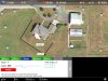
I added picture so you can see speed at some of the corners and in the middle of the leg.

I also added picture of my mission settings and from the log.

image1 (2).PNG image1 (2).PNG image2.PNG image3.PNG image4.PNG image5.PNG image6.PNG image1 (1).PNG image2.PNG
 
Quick update (will provide detail when I am back home) - Did my first flight using the app over the weekend (there was a small break in the weather) and overall found it useful and easy to use.

Did have one instance when the map was stuck as a vertical strip on the right hand side of the screen (setting had the video as PiP) and I had to restart the app.

The conditions were OK, winds were 10 kts gusting to 16 and the P3P was struggling with keeping the target point centered (will upload a video for reference).
 
I have just installed the App, and am setting up my first Target Mission. After watching the video, it is very intuitive to set up.

I have a couple of suggestions.

1. When setting up targets, it would be very helpful if concentric distance circles were displayed with the active Target at the center. Example in marked-up screenshot.

2. As an option it would be very convenient to set an ascent or descent speed from one waypoint to another instead of heights at the waypoint. The app would calculated the height at the next waypoint based upon the user's ascent/descent value.

Raining here now, but I can't wait to fly the mission. Thank you for accepting me as a tester!
 

Attachments

  • A.jpg
    A.jpg
    206.6 KB · Views: 298
I have just installed the App, and am setting up my first Target Mission. After watching the video, it is very intuitive to set up.

I have a couple of suggestions.

1. When setting up targets, it would be very helpful if concentric distance circles were displayed with the active Target at the center. Example in marked-up screenshot.

2. As an option it would be very convenient to set an ascent or descent speed from one waypoint to another instead of heights at the waypoint. The app would calculated the height at the next waypoint based upon the user's ascent/descent value.

Raining here now, but I can't wait to fly the mission. Thank you for accepting me as a tester!
Thanks for the suggestions.
1. We try to avoid adding too much information on the map, which is pretty crowded now. What do you think if we add the distance between waypoint and target in Waypoint panel instead of the map?
2. This is limited by DJI flight controller/SDK, and unable to set speed per each individual waypoint.

1. I understand about the crowding issue. If the circle distance guides were only visible when the particular target was active in the waypoint dialog, I don't think it would be a problem. For example, whenever a particular waypoint was active, it's target would have the guides. If you selected a different target for the waypoint, it would show the guides. When no waypoint is actively being edited, then no circle guides would be shown. The purpose of the guides would be to be able to accurately and repeatably set your waypoints distance from it's target.

2. I meant to say ascent or descent rate. Not the speed of the craft. Maybe you understood, and ascent/descent rate are not exposed to the SDK? The purpose would be to get smooth consistent climbs and descents between waypoints rather than guessing how fast or slow it will climb/descend based upon elevation adjustments alone.

Basically, these 2 suggestions would make it super easy to set up missions with known good parameters. For example. If I know that an orbit works best on a residence at 150' above and 100' around the structure, using the guides, I can set this up very quickly and precisely every time. If I like the way the video looks while climbing or descending at a given meters per second, I could set that up between waypoints. The app would calculate the elevation at the next waypoint to provide the desired rate. Me telling the app the elevation at the next waypoint is going to be hit and miss as far as trying to nail a smooth climb descent without spending a lot of time calculating distances beforehand.

Anyway, just suggestions. Thanks for listening and your feedback!
 
FYI, P3 and I1 are A2 based, while P2 is Naza based. Mission Planner (FPV Camera) supports P3P, P3A and I1 without requiring any hardware mods.
Thanks for the info! This was very helpful! Looking forward to this coming out soon!
 
1. I understand about the crowding issue. If the circle distance guides were only visible when the particular target was active in the waypoint dialog, I don't think it would be a problem. For example, whenever a particular waypoint was active, it's target would have the guides. If you selected a different target for the waypoint, it would show the guides. When no waypoint is actively being edited, then no circle guides would be shown. The purpose of the guides would be to be able to accurately and repeatably set your waypoints distance from it's target.

2. I meant to say ascent or descent rate. Not the speed of the craft. Maybe you understood, and ascent/descent rate are not exposed to the SDK? The purpose would be to get smooth consistent climbs and descents between waypoints rather than guessing how fast or slow it will climb/descend based upon elevation adjustments alone.

Basically, these 2 suggestions would make it super easy to set up missions with known good parameters. For example. If I know that an orbit works best on a residence at 150' above and 100' around the structure, using the guides, I can set this up very quickly and precisely every time. If I like the way the video looks while climbing or descending at a given meters per second, I could set that up between waypoints. The app would calculate the elevation at the next waypoint to provide the desired rate. Me telling the app the elevation at the next waypoint is going to be hit and miss as far as trying to nail a smooth climb descent without spending a lot of time calculating distances beforehand.

Anyway, just suggestions. Thanks for listening and your feedback!
Thanks again for the suggestions.
1. We are exploring a practical way to implement this. If we add circle lines every 50ft or 100ft, there will be dozens of circle lines if zooming out the map.
2. DJI SDK does support this in waypoint flight.
 
It seems this is related to Initial Height setting. I suggest to use "Standard" as Initial Height for the time being.
Ok, my initial height setting was 1st waypoint (400 ft) and the mission did not obey the corner setting.

Explain standard: Is this the one that goes to the initial waypoint at an angle? i.e. watch out for obstacles between the home point and the initial waypoint.

Can I set the initial waypoint directly above the home point and use standard for obstacle avoidance?
 
Last edited:
Ok, my initial height setting was 1st waypoint (400 ft) and the mission did not obey the corner setting.

Explain standard: Is this the one that goes to the initial waypoint at an angle? i.e. watch out for obstacles between the home point and the initial waypoint.
We figured this is likely due to an exception of DJI SDK. We fixed the issue and will release an update tomorrow.
 
  • Like
Reactions: gfredrone
Please read a post earlier in this page.

Not that I would try this but according to your post, In theory you would not need line of sight to complete the mission? Is that correct? All of the data is stored on the Phantom?

Your Previous Post
Once mission is uploaded and started, it will continue even lost signal. If Finish set to RTH, it will proceed standard RTH upon completion of mission regardless with signal or not. If Finish set to Hover, it will hover when mission completed regardless with signal or not.
In theory, you don't need LOS. Flight data is stored on aircraft, while gimbal/camera is controlled by the app.
 
A new beta update #3077 is available in TestFlight. What's new:
- Fixed: curved corner is ignored when Initial Height set to "RTH" or "1st-WP"
- Fixed: toggle map/FPV view offline auto-zoom properly
- Enhancement: mission (Auto-Tilt and flight path) will continues upon re-open mission, due to app crash or quit by user
- Other minor fixes
 
  • Like
Reactions: Oesau
Flew first Target Mission today.

Observations:

I couldn't really tell if video was being recorded after pressing the Controllers video record button. There was a red dot at the top, but I didn't remember if it was there before pressing the button or not. Is a red dot indication that it is recording or just that it is in video mode? Is video recorded automatically at mission start? Sorry if this is documented and I missed it.

While flying the mission, the camera view and the map view would freeze for a second then catch up continuously throughout the mission. For comparison, flying a DJI Go POI mission right after did not have the freezing. Smooth as silk.

Watching the recorded video, the app abruptly adjusts the gimbal tilt then flies along and then another abrupt adjustment. This did not happen all the time, just on one particular leg. It's as though it does not continually adjust toward the target and elevation but just checks and adjusts at certain intervals.

P3 Advanced, Latest Craft Fw, iPad Air2 on ios 9.0.2
A new beta update #3077 was just released several hours ago. Which version did you use?

In the new update, video recorder icon is dark red, it turns to red and blinking when recording plus recorder timer is counting. The easiest way is to turn on Auto Recording. It starts/stops video recording automatically when turning on/off motor. This is a handy feature to avoid forgetting start/stop video recording.

Did you enable Hardware Decoder in Advanced menu? Did you also use screen recorder during your mission flight? Both of these might have impact to iPad performance.

The abrupt adjustment is a known issue (when Initial Height set to "RTH" or "1st-WP"), which is fixed in #3077.
 
When flying yesterday I noticed that if the DJI GO app is set to photo rather then video, the app will not record nor did it give me a notification of the problem. I might have missed it tho as I was looking up half the time. :) I really like this app! It is what I find myself using most of the time.
 
Will it reconnect to DJI Go if it is left running in the background if you want to switch back to DJI Go? If you have done a recalibration in DJI Go before you start FPV Cam, is it better to close DJI Go or does it even matter that it is left open?
 
When flying yesterday I noticed that if the DJI GO app is set to photo rather then video, the app will not record nor did it give me a notification of the problem. I might have missed it tho as I was looking up half the time. :) I really like this app! It is what I find myself using most of the time.
If you enable "Auto Recording" in the latest #3131, it would switch to video mode and start/stop recording automatically upon motor start/stop. Obviously, you may also use the physical recorder button on RC to start/stop recording manually.

We recommend to shutdown DJI GO app if not using it to avoid conflict.
 
A new beta update #3077 was just released several hours ago. Which version did you use?

In the new update, video recorder icon is dark red, it turns to red and blinking when recording plus recorder timer is counting. The easiest way is to turn on Auto Recording. It starts/stops video recording automatically when turning on/off motor. This is a handy feature to avoid forgetting start/stop video recording.

Did you enable Hardware Decoder in Advanced menu? Did you also use screen recorder during your mission flight? Both of these might have impact to iPad performance.

The abrupt adjustment is a known issue (when Initial Height set to "RTH" or "1st-WP"), which is fixed in #3077.

This was not on the latest beta release.

It sounds like you have the recording notification handled.

I have never had Hardware decoding on using the Go App, and have never had a single issue with judder or increased latency on the Air 2. Are you saying that your App is more resource intensive than the Go App? I thought it was the worst as far as a resource hog.
 
Will it reconnect to DJI Go if it is left running in the background if you want to switch back to DJI Go? If you have done a recalibration in DJI Go before you start FPV Cam, is it better to close DJI Go or does it even matter that it is left open?
We suggest to shutdown DJI GO and power cycle the aircraft after calibration to avoid conflict prior starting FPV Camera. If you need switching to GO at any time, simply open it again.
 

Members online

No members online now.

Forum statistics

Threads
143,066
Messages
1,467,358
Members
104,936
Latest member
hirehackers