Fly away

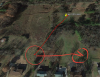
Those are kinda scary velocities - I don't believe them either. I did some calcs using the GPS coords at time 582.501 secs and at time 585.754 secs which yielded a velocity of 10 mph, heading 201°. Seems like another poster speculated the wind was 10 mph, although at a SE heading.:)

We don't know the scale of the GPS DOP signals except to say they aren't the "standard" scale. But, GPS(0):pDOP and GPS(0):hDOP both have relatively low values. (Compared to the first part of this flight and other flights I've seen).The numSats is 16.

So to answer your question I'm leaning towards the GPS coords data are probably OK.. Those velocities do give one pause though.

OK - working directly from the last 5 seconds of GPS coordinates I get basically the same 10.4 mph @ 200°. I think I posted the wind calculation from AirData, which was around 10 mph out of the NNW, but I'm not sure how much we can trust the log data that it was based on, so if it was drifting on a course of 200° that's probably not inconsistent.
 
  • Like
Reactions: BudWalker
I think so too and since that's more than likely what it is... There's no telling what direction it was really in. There's no telling what direction it went it could have been anywhere giving off any kind of signal
Seems the problem was intermittent. There are intervals where the data is clearly wrong. But, when it was working the data was accurate as it doesn't show any randomness. I still think it's downwind of the tack location on that geoImage. That is, if the kid doesn't have it.
 
  • Like
Reactions: sar104
Seems the problem was intermittent. There are intervals where the data is clearly wrong. But, when it was working the data was accurate as it doesn't show any randomness. I still think it's downwind of the tack location on that geoImage. That is, if the kid doesn't have it.

Agreed. It's unfortunate that we don't have any idea of the status of the uplink when the downlink failed.
 
So I should continue Southwest? About 200°? That is about where that field is on the Tack location from where I took off
 
So I should continue Southwest? About 200°? That is about where that field is on the Tack location from where I took off

That was the last recorded track, so yes. If it lost uplink at the same time and was still in ATTI mode then it will have auto landed. From 80 m up and descending at 2.5 m/s and a 5 m/s drift it might have traveled another 160 m.
 
  • Like
Reactions: BudWalker
So I should continue Southwest? About 200°? That is about where that field is on the Tack location from where I took off

This shows the GPS data from the flight record.

screenshot131.jpg
 
  • Like
Reactions: Kissthesky
I saw your other thread where DJI is replacing your bird. Congratulations!
Thanks... I should have it tomorrow but I'm not taking off until I have everything planned out first. Insurance, I have everything planned out first... insurance GPS locator, parachute! I'm going to Max this baby out!
 
That his last known coordinates correct? It looks like it still pretty high at that point but starting to come down so maybe we will give it one more shot!

As @BudWalker pointed out, those later GPS coordinates appear to be quite credible.
 
  • Like
Reactions: Kissthesky
That was the last recorded track, so yes. If it lost uplink at the same time and was still in ATTI mode then it will have auto landed. From 80 m up and descending at 2.5 m/s and a 5 m/s drift it might have traveled another 160 m.
@Kissthesky This and the last GPS coords puts the P4P about here.
upload_2018-4-17_5-52-37.png
 
  • Like
Reactions: CANEKiTA
Good to hear it has been recovered. Try not to lose it again. You may want to consider an electronic tracker (Trackimo/MarcoPolo) for the next time the bird goes wandering around the countryside without you. [emoji106]
 
  • Like
Reactions: Neon Euc
Oh...This bird probably won’t ever fly again or at least not for a long time! I am ordering a Marco Polo tracker today.
 
  • Like
Reactions: Neon Euc
Oh...This bird probably won’t ever fly again or at least not for a long time! I am ordering a Marco Polo tracker today.

I’m sure she will fly again! As for the Marco Polo, that’s what I use on my birds. Trackimo is good also, but I have spotty cell service where I fly, so it’s gps effectiveness is limited. Plus I don’t like the monthly service fees.
 
Yeah I was like...what if I’m in the mountains? I didn’t really want monthly fee either
 

Recent Posts

Members online

Forum statistics

Threads
143,095
Messages
1,467,612
Members
104,981
Latest member
brianklenhart