- Joined
- Jul 5, 2018
- Messages
- 10
- Reaction score
- 1
- Age
- 70
Hi Guys,
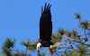
I’m so new I don’t even own a drone yet, but I need to get one so I can try and locate bald eagles nest in Florida for a program called Eaglewatch. Can anyone shed some light about the capability of drones providing accurate GPS coordinates? I will have a general idea based on Florida fish and wildlife data of where the nest is located but much of that has not been verified in years. For the most part, I will not have eyes on the drone and it will be flying mostly above wooded areas. Do these drones capture a GPS location when I take a picture or turn on video? Any guidance would be appreciated
John

")