- Joined
- Mar 10, 2017
- Messages
- 467
- Reaction score
- 109
- Age
- 64
I think that's how this is all supposed to work. I thought I heard that when ATC received these requests, they would look at your mapping height and at these maps to see if you posed a hazard. Hopefully this is all done automatically and will allow for faster assessment times.I could put what my location would be and that I would stay below X ft according to the map
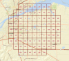
Cool! I'm looking at a nearby airport, Northwest Alabama Regional, which is Class E sfc. I like the graduated ceilings from 0 to 400ft at the edge of the Class E sfc radius. Essentially, this would help in applying for authorization if I wanted to fly within that Class E sfc area, that I could put what my location would be and that I would stay below X ft according to the map? Is that correct?
The grids are actual Lat / Long. lines by minutes. You can see this as the Lat. / Lon. is displayed in the bottom left corner of the may as you move your mouse over the grid.Is it me or are all the grids way offset from the actual airports
We use essential cookies to make this site work, and optional cookies to enhance your experience.