Relatively new user here...
I've had Litchi now for a week or so, and I feel comfortable using it but i've had a few things come up that I can't figure out;
1.) For the 'Actions' choice... I can't get Litchi to automatically record video. It just wont do it... I am using curved turns *later on* in the missions, but the first waypoint has no curves, so I assume it should be able to turn on the recorder? For example, if i have a mission circling my house, with 10 waypoints... I click on waypoints 2-10 and use a curve on those to make the path smooth. I set the first waypoint to sit still for 10 seconds, then start recording video, then fly the mission. It refuses to turn on the video capture every time. Everything else with waypoints seems to be working for me.
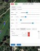
2.) For iOS vs. using a computer/PC to access the Mission Hub... It seems as though the iOS version/App version of Litchi has no support for showing the 'relative to the ground' feature? Whats going on there? Whenever I look at my missions I have created, on the iOS app it doesn't show the 'relative to the ground' adjustments at all. If I look up the same mission on my PC via the website, they are there, you see one cloud for the altitude you have chosen in yellow (Relative to the ground above the waypoint), plus one right next to it for the adjusted altitude, relative to your home position(in white). Seems like all of this should be shown on the app, too? Lastly- Based on the previous info, for the most part it seems like 'Above Ground' is just not an option for the iOS app, so best practice would be to ONLY create missions on the website/using a PC and then just double check the math/figures once you load the mission to the app?
Thanks in advance,
I've had Litchi now for a week or so, and I feel comfortable using it but i've had a few things come up that I can't figure out;
1.) For the 'Actions' choice... I can't get Litchi to automatically record video. It just wont do it... I am using curved turns *later on* in the missions, but the first waypoint has no curves, so I assume it should be able to turn on the recorder? For example, if i have a mission circling my house, with 10 waypoints... I click on waypoints 2-10 and use a curve on those to make the path smooth. I set the first waypoint to sit still for 10 seconds, then start recording video, then fly the mission. It refuses to turn on the video capture every time. Everything else with waypoints seems to be working for me.
2.) For iOS vs. using a computer/PC to access the Mission Hub... It seems as though the iOS version/App version of Litchi has no support for showing the 'relative to the ground' feature? Whats going on there? Whenever I look at my missions I have created, on the iOS app it doesn't show the 'relative to the ground' adjustments at all. If I look up the same mission on my PC via the website, they are there, you see one cloud for the altitude you have chosen in yellow (Relative to the ground above the waypoint), plus one right next to it for the adjusted altitude, relative to your home position(in white). Seems like all of this should be shown on the app, too? Lastly- Based on the previous info, for the most part it seems like 'Above Ground' is just not an option for the iOS app, so best practice would be to ONLY create missions on the website/using a PC and then just double check the math/figures once you load the mission to the app?
Thanks in advance,
") I feel like the curves really make for a lot smoother video overall so I will just stick with that. I does let me enter the two Actions tho... So on my Waypoint it lets me add/enter both "STAY" and "START RECORDING" without any error messages? Again, no big deal Im just curious as a new user;
I feel like the curves really make for a lot smoother video overall so I will just stick with that. I does let me enter the two Actions tho... So on my Waypoint it lets me add/enter both "STAY" and "START RECORDING" without any error messages? Again, no big deal Im just curious as a new user;