- Joined
- Mar 31, 2017
- Messages
- 30
- Reaction score
- 1
- Age
- 37
Hello,
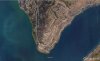
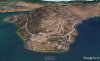
I received a job last week to fly approximately 900 acres with a topographic relief of 400m. My client requires an orthophoto (5cm GSD) and a DEM. I went out and set 14 GCPs around the site and tied them in with RTK. Half of the site is in an altitude limited zone of 60m due to a nearby airport.
Using DroneDeploy and an above terrain altitude of 60m caused my phantom 4 pro to almost crash into some trees due to what I believe was a inaccurate DEM of highly variable terrain. There is also the issue of constantly losing lock at 60m because of the hilly terrain. I can probably get permission from the airport to fly above 60m during a certain time as I do have my radio licence but DroneDeploy will still not allow me to enter a higher elevation. Map Pilot by drones made easy will, but it has been extremely buggy for me. This same job it would fly out until it lost radio connection and just hover there until it RTH from a low battery instead of continuing to fly the mission.
Any recommendations on how you would approach this project?