- Joined
- Oct 22, 2018
- Messages
- 20
- Reaction score
- 3
- Age
- 63
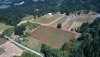
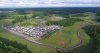
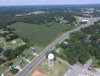
Does anyone have or know a formula to figure how high we wold have to fly in order to photograph 1 acre of land? What about 10 Acres or 50 acres? I live in a rural area and have been asked to photograph some farmland, all in one shot.
I was just wondering if there is a way to figure how high I would have to fly in order to photograph a certain size piece of land?
I realize of course that it would depend on the shape of the property. For the sake of making this easier, let's pretend the farm is square.
If I was asked to photograph a 50 acre farm, how high would I have to be?
Thanks in advance for your help.