

- Joined
- Aug 16, 2013
- Messages
- 30
- Reaction score
- 0
The release version DronePhone Map Client for Windows is shown below:
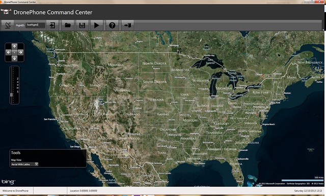
The toolbar buttons are, from left to right:
* Connect to Server
* Enter FlightID (from DronePhone Tracker)
* Disconnect from Server
* Load Recorded Flight
* Save Recorded Flight
* Play Recorded Flight
* Help
* Exit
On the map, we have the following controls:
Pan left, right, up, down and return the map to center.
Zoom bar
Tools area where we set the map to "Aerial with Labels", "Aerial", and "Road" views
At the bottom is a status bar area which shows the current drone position, altitude, heading and speed.
I would appreciate any feedback on the design.


