

Hi
Our compeny is investigating the ability to complete drone surveys of landscapes with the aim of creating 3D models to be used in AutoCAD for measurment purposes - these will be for surveys of watercourses to assess their viability for hydropower projects. Accuracy needs to cm level - max 10cm for outline survey or cm level for design work.
I understand to get this accuracy level we need to use RTK GPS to be able to set out Global Control Points (GCP) visible by the drone. Being a complete novice to this I have a couple of questions, would greatly appreciate some comments.....
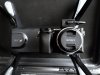
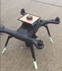
We were thinking of using a DJI Drone.
Firstly, I presume we need to make obtain accurate coordinates and elevation of all the GCP's which we can do with an RTK base/rover.
Secondly, do we also need RTK GPS on the drone itself, or can software create a 3D model if the drone can see and reference GCP's from the air?
Thirdly, are there any special camera requirements for what we need to do, beyond that available on lets say a DJI Phantom 4?
We were thinking of using software like Pix4D software to create the model and then Autocad ReCap to get it into AutoCAD....
Would greatly appreciate someone giveing me an overview of the components needed to acheive the desired result.
Thanks ever so much for your help...
Arun
Our compeny is investigating the ability to complete drone surveys of landscapes with the aim of creating 3D models to be used in AutoCAD for measurment purposes - these will be for surveys of watercourses to assess their viability for hydropower projects. Accuracy needs to cm level - max 10cm for outline survey or cm level for design work.
I understand to get this accuracy level we need to use RTK GPS to be able to set out Global Control Points (GCP) visible by the drone. Being a complete novice to this I have a couple of questions, would greatly appreciate some comments.....
We were thinking of using a DJI Drone.
Firstly, I presume we need to make obtain accurate coordinates and elevation of all the GCP's which we can do with an RTK base/rover.
Secondly, do we also need RTK GPS on the drone itself, or can software create a 3D model if the drone can see and reference GCP's from the air?
Thirdly, are there any special camera requirements for what we need to do, beyond that available on lets say a DJI Phantom 4?
We were thinking of using software like Pix4D software to create the model and then Autocad ReCap to get it into AutoCAD....
Would greatly appreciate someone giveing me an overview of the components needed to acheive the desired result.
Thanks ever so much for your help...
Arun


")


