Here is the steps to import Vision Pilot log file to Dashware:
1. Download the Dashware profile file at
download/file.php?id=15623
2. Using winrar
http://www.rarlab.com/download.htm to uncompress the rar file to "Vision Pilot.xml"
3. Copy the "Vision Pilot.xml" to Dashware Data Profile Directory C:\Users\Documents\DashWare\DataProfiles
4. Rename your exported csv file of format YYYYMMDDhhmmss-logID.csv to file of format YYYYMMDDhhmmss.csv (eg. 20150308160615-92138778327.csv to 20150308160615.csv)
5.Launch Dashware and press Ctrl+N to new a project
6.Add data file to new project
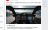
7. Select your data file and "Vision Pilot" as data profile
8. Click on Synchronization to sync the map with new imported flight data
https://www.facebook.com/notes/vision-p ... 5329758508


")