Matrice 210 RTK-G - Thoughts

Joined
Feb 12, 2017
Messages
2
Reaction score
0
Age
41
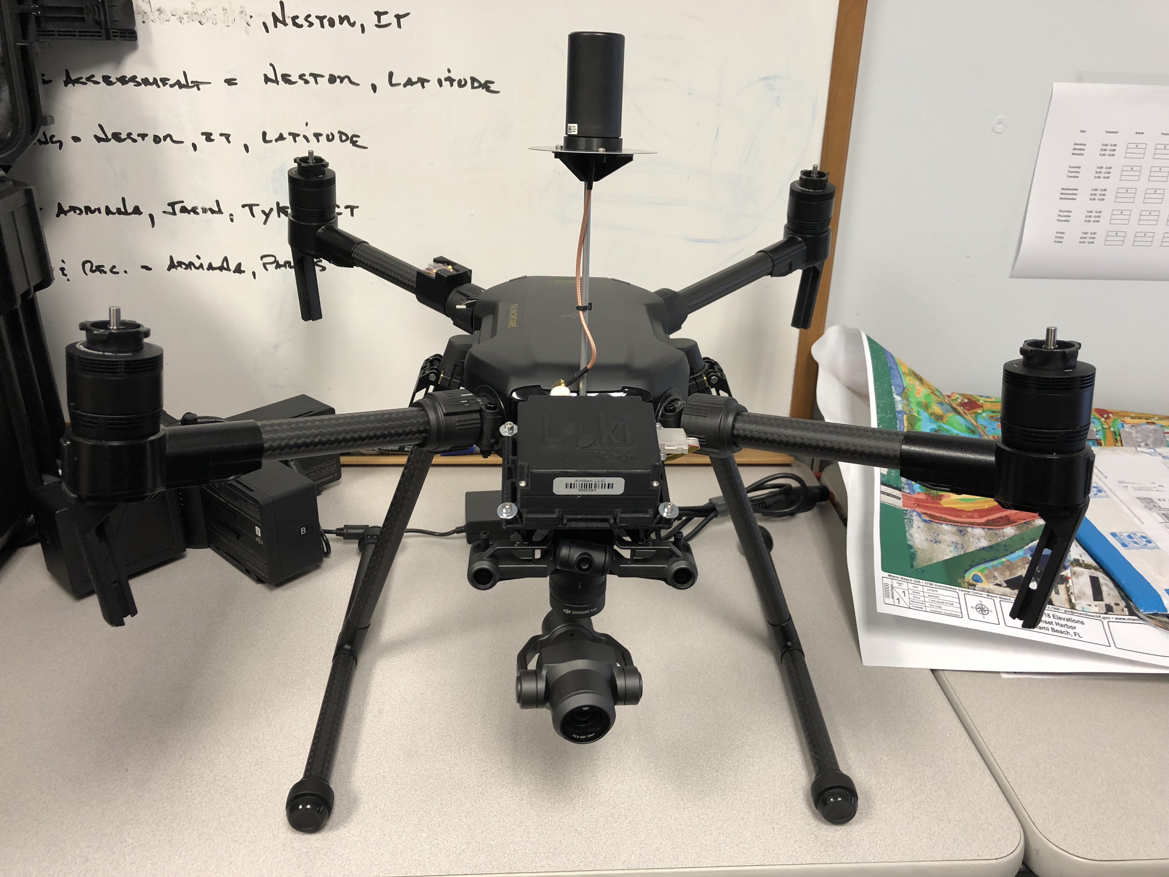
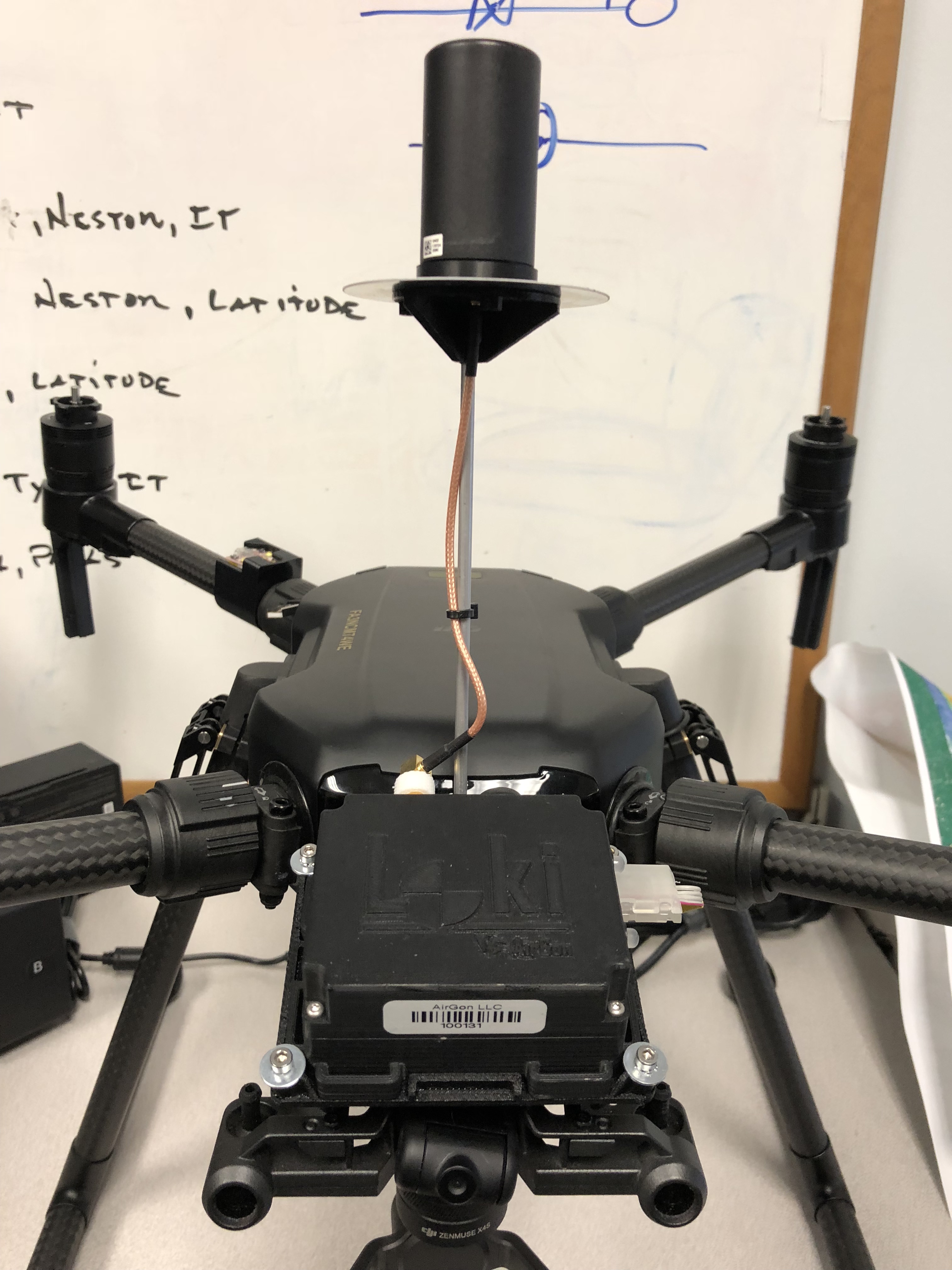
Anyone have an opportunity to work with a Matrice 210 RTK-G yet?
I currently use a P3P (only thing I could get management to sign off on) which has been performing well, but I lose compass when I'm launching near a lot of the structures.

I like the idea of a dual gimble with thermal and zoom camera. I'm not comfortable flying close to some of our larger towers so I'm not getting the best photos/video I could, but I would rather that then crashing and having to explain to the boss.
 
The M210 RTK is a beast of a machine but it adds several layers of complexity (in software, hardware, setup, flight, data processing, and maintenance) in addition to absolutely destroying the average budget.

With all due respect going from P3P to the M210 RTK is like going from a nice solid Big Wheel to a new Suzuki Hayabusa.
 
Last edited:
  • Like
Reactions: ravedog
BigAl7 - Appreciate the response. In regards to complexity what sorts of things do you mean?
No disrespect at all, I like the candidness.

I know it's a huge upgrade. It's taken me 2 years of demonstrating that UASs are not 'Toys' but can be used to conduct some amazing missions that keep staff out of harms way. I've gotten some new management that wants to put some money into the program. I figured I should aim big and the M210 looks to be the one that checks off each box of things we need.
 
I just pick up a new Matrice 210-RTK a week ago. I'm still conducting test flights without cameras. I've got a Zenmuse XT and Z30. The dealer said to run through the batteries a few times w/o cameras; as there have been reports of bad cells on delivery. There are a lot of quirks I am learning to get around. For one, dual gimbal control is currently supported in DJI Pilot and not DJI Go; as is dual controller support. DJI Pilot is missing functionality that Go has. Such as, we can't configure buttons on the Cendence controller in DJI Pilot. FPV view only has two positions 0 and 45 degrees down (no way to control it with a dial). DJI Pilot is currently only available on Android. I planned on using an iPad for the second Inspire controller, but now need an Android tablet. The Cadence uses more power than expected so I will be picking up additional batteries for it. I can't figure out what the SD card on the 210 is for as you can't record to it.

I am impressed with the RTK. Worked perfect first time. Also the ADS-B is great and notified us of nearby aircraft. The zoom on the Z30 is great, but realize it is only 1080 not 4K. Ground tests allowed us the read typed pages at 10 meters. The aircraft is rock steady, even in 20 mph gusty winds, and with hit 55 MPH in sport mode.
 
BigAl7 - Appreciate the response. In regards to complexity what sorts of things do you mean?

@jc15 has touched on a few and they have only had it a week now. Learning to operate more advanced cameras, multiple cameras, multiple types of control system, in addition to a totally new flying platform is a lot to learn all at once.
 
We unboxed our M210 two weeks ago. Ran through the IMU calibrations. Updated Firmware then we hit a snag. Our XT camera model, XT-01, needs to be upgraded. We downloaded the
Zenmuse XT Firmware for Matrice 200 Series 2017-06-28 But we haven't had any success getting it to load from the bin file.

I was then told by the company who sold us the XT that it would need to be sent in for an upgrade and I should contact DJI support:(
I did, and the guy at DJI NA seemed to not know about any upgrade but told me to go ahead and ship it in via their online ticket system which it turns out has no way of selecting a camera for repair option???
 
I have read before that the RTK functionality with DJI only seems to keep the drone in position and does nothing for geotagging. Is this still the case? If so, is there any better way to get survey grade geotagged images outside of ground control points captured with a base + rover?


You might get more response on this from our sister forum:
Commercial Drone Pilots Forum
 
I fly an M200 at work with a GeoCue Loki GPS unit attached. I consistently get 1.5 inches vertical with no ground control points. This is using post processing. With GCP I get 0.6 inch vertical. You can use a P4P with a Loki but not as stable as the M200. Same results though.

m200_loki_1.jpg


m200_loki_2.jpg
 
Last edited:
  • Like
Reactions: BigAl07

Members online

Forum statistics

Threads
143,066
Messages
1,467,358
Members
104,936
Latest member
hirehackers