To the collective brains trust. I've been approached by a colleague (licensed surveyor) to put an expression of interest in to provide an aerial survey of a proposed walking trail.
What is required is:
I've flown several sites to practice creating maps and I'm having reasonable success with the Pix4D app. I'm far from being an expert and yet to incorporate GCPs in my workflow but I have 3 months to get comfortable with using them to add the accuracy that I need.
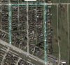
My initial question is how many GCPs would be required to cover the daily 10km x 10m corridor to produce the 50-100mm accuracy my client needs. I'm also thinking that I could double the corridor width to 30m without too much extra processing time so that they can have more options to route the track.
I've also read that some mapping solutions are better for corridors than others. Recommendations would be greatly appreciated.
Many thanks in advance for answers to these questions..
What is required is:
- 10 meter wide corridor survey along the 300km route.
- Accuracy is 50-100mm on the ground.
- Cover 10km per day.
I've flown several sites to practice creating maps and I'm having reasonable success with the Pix4D app. I'm far from being an expert and yet to incorporate GCPs in my workflow but I have 3 months to get comfortable with using them to add the accuracy that I need.
My initial question is how many GCPs would be required to cover the daily 10km x 10m corridor to produce the 50-100mm accuracy my client needs. I'm also thinking that I could double the corridor width to 30m without too much extra processing time so that they can have more options to route the track.
I've also read that some mapping solutions are better for corridors than others. Recommendations would be greatly appreciated.
Many thanks in advance for answers to these questions..