Not seeing map on my Nextbook display

Joined
Sep 23, 2016
Messages
7
Reaction score
1
Age
54
Hey guys! bought a nextbook for my Phantom 3. It has GPS on it, however when I fly my drone it doesn't show the location of the drone on the screen's map. Is that a setting on the tablet? or is because the tablet is wifi only and not using a 4g type of signal? I was under the impression that if the drone is connected to the tablet via wifi it will automatically transmit it's location back to the tab as long as the tab's GPS is enabled.
 

Attachments

  • image1.jpeg
    image1.jpeg
    1.9 MB · Views: 343
Im sure Data is required to load the 'Map view' within the dji go app. so although the rc should report the drone's gps location. you will not see it on a map without the tablet being able to load the map through data though a 3g/4g data connection.

The tablet will probly not be able to connect to you homes wifi and the rc wifi at the same time. (this isnt usual anyway)

You need a device that can connect to the rc through wifi and then use a 3g/4g data connection to load the map on dji go the drone doesn't have internet connection

Yeah, that's what I thought. Thanks so much Georgia. Fortunately, I have an IPAD-2 through work that had 4g capability. I was hoping to not have to use it.
 
  • Like
Reactions: George McCann
Yeah, that's what I thought. Thanks so much Georgia. Fortunately, I have an IPAD-2 through work that had 4g capability. I was hoping to not have to use it.
When you have a WiFi connection with internet, play back your flight, does the map work then?
 
As far as I know, open the app, and view the map of the area you are going to be flying, then leave the app open, something like that.:rolleyes:

Rod

Oh, BTW, Welcome to the Forum!
 
Hey guys! bought a nextbook for my Phantom 3. It has GPS on it, however when I fly my drone it doesn't show the location of the drone on the screen's map. Is that a setting on the tablet? or is because the tablet is wifi only and not using a 4g type of signal? I was under the impression that if the drone is connected to the tablet via wifi it will automatically transmit it's location back to the tab as long as the tab's GPS is enabled.
GPS does not deliver maps to the tablet.
The only use for GPS in your tablet is to use Follow-me or resetting your home point to the current location of the controller.
With no GPS in tour tablet, the app can show the positions of the Phantom and the recorded home point on a map.
But you need a way to get the background map from Google.
That can be either using live cell phone data if available ...
... or what many of us use ... cached (stored) maps.

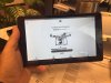
Simply open your app at home when connected to wifi.
Open the camera view and then the map view.
Make it full screen and find the area you are interested in.
Scroll around at the detail level you want.
You can now close the app and power down the tablet.
That's it ... you've now cached your map and it will be available next time you go flying there.
 
Thanks Man, I knew I was close.
:)

Rod
 

Members online

No members online now.

Forum statistics

Threads
143,054
Messages
1,467,297
Members
104,919
Latest member
BobDan