I have come back to Litchi after about a year and am getting peculiar results with the export option.
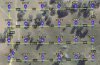
I use relative to ground (RTG) altitudes and in the Litchi app I see both the relative to start (RTS) and computed RTG altitude at each point on the map (see attached image). Also when I save the flight and load it in Missdion Hub, and click on a waypoint a message (eg. Ground Elevation 458.8m (57.1m below first waypoint) is displayed.
So the Litchi flight appears correct.
If I export to KML the altitudes appear to correctly follow the terrain.
If, on the other hand, I export to CSV all altitudes are output at the original altitude (101m) before I did a batch edit and converted frome Home to Ground.
I use these CSV files loaded into QGIS for display and I have checked files created a year ago in the same way and they have the correct RTG values in the altitude column.
I am at a loss to understand what I am doing wrong.
Any help appreciated.
CSV File
latitude longitude altitude(m) heading(deg) curvesize(m) rotationdir gimbalmode gimbalpitchangle actiontype1 actionparam1
-35.2785 148.064 100.973 0 0.2 1 0 0 5 -90
-35.277 148.0638 100.973 0 0.2 1 0 0 5 -90
-35.277 148.0645 100.973 0 0.2 1 0 0 5 -90
-35.277 148.0651 100.973 0 0.2 1 0 0 5 -90
-35.277 148.0658 100.973 0 0.2 1 0 0 5 -90
...
KML file
...
<coordinates>
148.06399702579495,-35.27845582693011,616.8779449462891
148.0638388637542,-35.27698437979623,621.2831573486328
148.06448,-35.27698,621.1629180908203
148.06514000000004,-35.27697,620.5124664306641
148.06579999999997,-35.27697,618.0609893798828
148.06646,-35.27696,612.0817413330078
...