- Joined
- Oct 30, 2014
- Messages
- 32,283
- Reaction score
- 10,985
- Location
- Harrisburg, PA (US)
- Website
- phantomhelp.com
Using Airmap to Request FAA Authorization
Before flying in controlled airspace (Classes B, C, D, and E Surface) in the US, you must get authorization from the FAA. Airmap is an approved LAANC UAS service supplier and has a feature built into their iOS/Android app that allows FAA authorization to be requested through LAANC. In most cases, requests can be submitted and approved within a few minutes.
Steps to Request FAA Authorization with Airmap
Follow these steps to request FAA authorization for a flight you’d like to take right now or at some point in the near future:
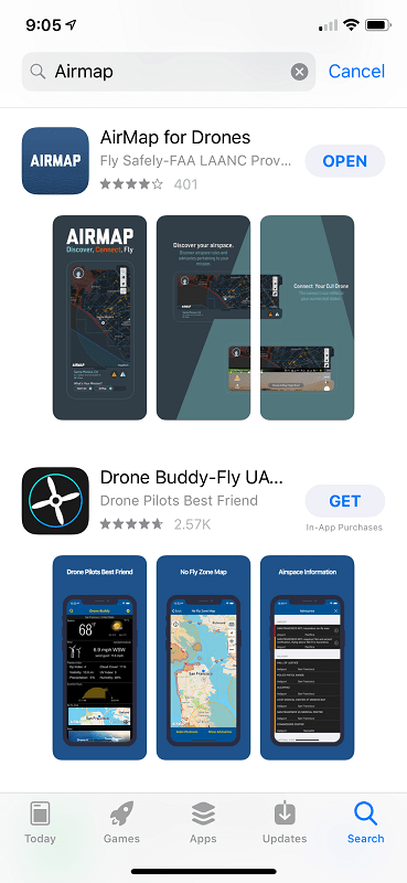
1) Install the Airmap app from the app store on your iOS or Android mobile device.
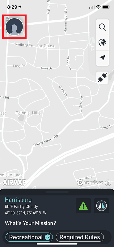
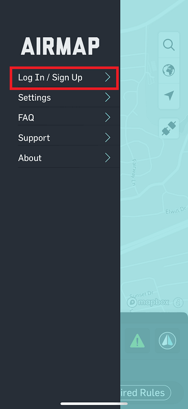
2) Tap the avatar icon at the top, left corner and log into your Airmap account.
 __________
3) At the bottom, left corner, choose the type of flight you’re going to take (Recreational or Part 107).
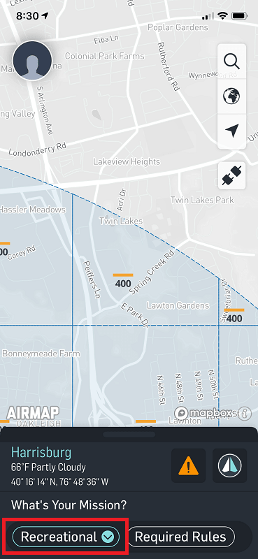
4) Drag the map to the location where you’d like to fly – and then tap and hold the map in the location where you’d like to take off. That should create an orange circle on the map. This orange circle represents the area where you’re going to stay within during your flight.
Tap and drag the “Radius” slider to increase/decrease the flying area.
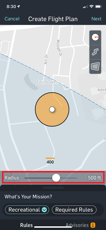
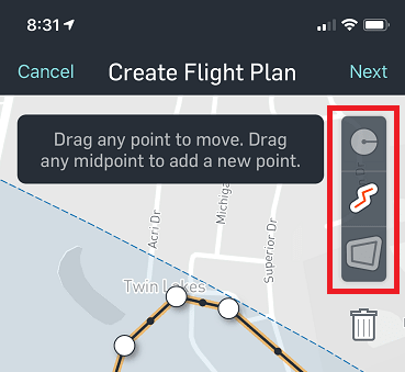
If you’re flying area is not a perfect circle, you can use the other tools in the toolbar on the right to map out the flying area by drawing the flight path or draw a non circular area on the map.
After setting your flight area, tap “Next” at the top, right.
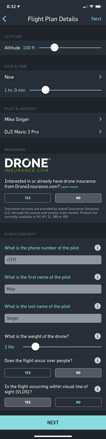
5) Enter your flight plan details and tap the “Next” button.
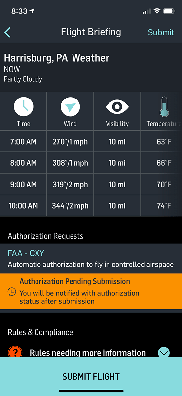
6) Tap the “Submit Flight” button at the bottom to submit your flight plan for authorization.
 __________
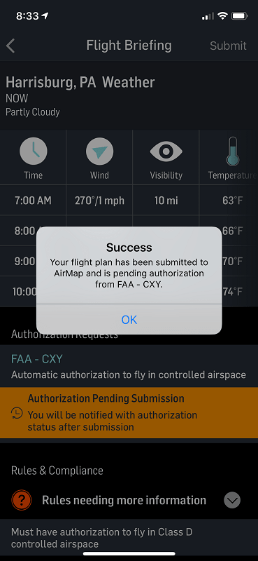
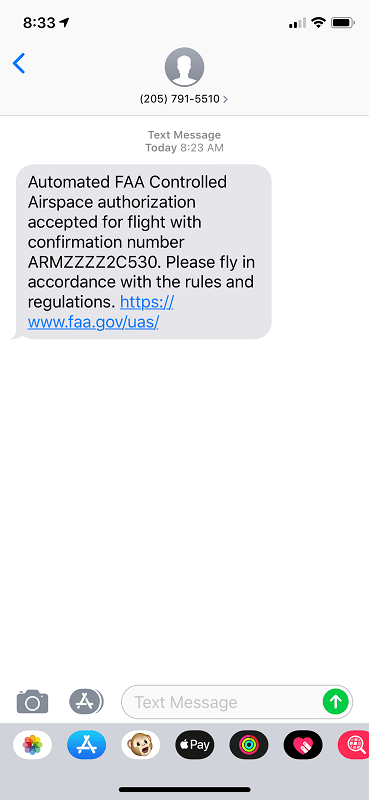
7) You’ll receive a text message when your flight has been authorized. This normally takes no longer than a minute after your flight plan has been submitted.
Before flying in controlled airspace (Classes B, C, D, and E Surface) in the US, you must get authorization from the FAA. Airmap is an approved LAANC UAS service supplier and has a feature built into their iOS/Android app that allows FAA authorization to be requested through LAANC. In most cases, requests can be submitted and approved within a few minutes.
Steps to Request FAA Authorization with Airmap
Follow these steps to request FAA authorization for a flight you’d like to take right now or at some point in the near future:
1) Install the Airmap app from the app store on your iOS or Android mobile device.
2) Tap the avatar icon at the top, left corner and log into your Airmap account.
3) At the bottom, left corner, choose the type of flight you’re going to take (Recreational or Part 107).
4) Drag the map to the location where you’d like to fly – and then tap and hold the map in the location where you’d like to take off. That should create an orange circle on the map. This orange circle represents the area where you’re going to stay within during your flight.
Tap and drag the “Radius” slider to increase/decrease the flying area.
If you’re flying area is not a perfect circle, you can use the other tools in the toolbar on the right to map out the flying area by drawing the flight path or draw a non circular area on the map.
After setting your flight area, tap “Next” at the top, right.
5) Enter your flight plan details and tap the “Next” button.
6) Tap the “Submit Flight” button at the bottom to submit your flight plan for authorization.
7) You’ll receive a text message when your flight has been authorized. This normally takes no longer than a minute after your flight plan has been submitted.
Last edited: