How accurate is the GPS when used in waypoint mode?

Joined
Feb 14, 2016
Messages
77
Reaction score
4
Location
Somewhere up there over Norway
I have a 3-4 meter (10-12 feet) wide and around 50 meter long (150 feet) road that I want to fly down in a very fluid motion, before arriving at the house and doing a flyby of the house for an ad. I'm trying to sell the house. :) I made one point of interest video first (I'm standing at the deck of the garage to the left):

To view this content we will need your consent to set third party cookies.
For more detailed information, see our cookies page.

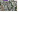
You can see the road I mean at the begining, in the lower left corner. But is the GPS accurate enough to do that kind of a trick? The road has trees scattered on both sides, so if I fly the mission dead center of the road first and then let it rip, how much of a risk am I taking? I can't fly it fluid enough down that road for the video to be as good as I want it to be. There is a bit of money at stake here! :D

Oh, and another thing: Is it possible to put in a 360 degree pan in such a mission. Sort of "stop in front of the terrace of the house, do a 360, and then fly on"? Maybe I should have a look at Litchi for stuff like that? I haven't tried that yet, but I suspect that may have those kind of options.
 
Last edited:
You could increase your chance of success by flying on a day/time where you have the max satellites visible according to uavforecast.

If you're worried, you could fly it manually down the road while walking behind it, then speed up the video.

Or you could do waypoints at the slowest speed possible so that you have time to interrupt it if it is going to hit a tree. If that works, you could do it again, faster.

I believe you can rotate the quad manually during a waypoints mission, but you cannot program it to rotate.

Hope this helps
 
I guess for standard GPS the average best would be 15 meters and the average worse close to 30-40 meters. Please correct me if I'm wrong.

I have a similar plan. Maybe best to walk behind the AC on a non-windy day with slow movements, then speed it up in post. Would you suggest using ATTI mode?
 
15 meters? Well, that's totally useless for me. :( And I was thinking about using waypoints and then have the speed set to 0, so I only have to control the speed. If I can rotate manually, that would probably work, only I am not (at least not in my own eyes) good enough at doing a rotation fluid enough, even with all the tricks from the forum (adjustment of gain, and all that). But if it can actually float as much as 15 meters I think I'll just strap it to the roof of the car and drive down, letting the gimbal even out the bumps in the road. But I'm going to check out Litchi and see if that can do a fluid rotation.
 
I just read the help file of Litchi, and it seems it can be set to fly to a waypoint, do a rotation to the degrees I want to and then fly to the next, and so on. So that's really interesting. I guess I'll have to try it. :D
 
For this i would use autopilot. You can fly the mission and set waypoints underway, and it will allso record the camera angle/pitch if you like.
What i like to do is set the path run by autopilot, then set the focus strategy to joystick. So the aircraft will fly the waypoints, while i focus on the shot with the right stick (yaw/pitch)


Sent from my iPhone using Tapatalk
 
I've heard very good things about autopilot. right now I'm using litchi and it does exactly what you want, OP. I've done a waypoint mission through a few neighborhood streets and it followed it perfectly and smoothly using curved angles.
 
  • Like
Reactions: n6vmo
I composed a mission on my Android phone using Litchi. The mission was to fly around the neighborhood at 36' down the middle of the road. This altitude was at or below most of the houses and trees, no room for error. I wanted to smoothly capture the Halloween spirit from the air, with smooth panning. The speed was 4MPH, just enough for me to walk below the craft and monitor its progress throughout the 11 minute and .4 mile trip.

Panning was done using way points.

It tracked perfectly down the middle as you can see from this video. You can best see the accuracy from 2:50 to 3:50 into the video. This section of the neighborhood was a slight up hill and you can see the craft dropped below the houses, this was where the most accuracy was needed. Litchi and the P3 did not fail me.

To view this content we will need your consent to set third party cookies.
For more detailed information, see our cookies page.

Here is the mission....download it, unzip it and open it with Litchi.

The 10 - 12 foot wide path should not be a problem as long as you are tracking many satellites.
 

Attachments

  • Halloween 1.zip
    399 bytes · Views: 179
Last edited:
  • Like
Reactions: Comte de Bleuville
Man, that was seriously cool! :DLove the John Carpenter soundtrack, how did you avoid it being taken off by YouTube's copyright nazis? Loved the guy up against the pickup, he really looked the part of a dangerous local from any survival horror movie! :p So you can program the panning during the trip like that? Even flying backwards! I had misunderstood, I thought that you needed to stop to do a pan, on a waypoint. I am going to sit down one of these days and look through Litchi with that mission so I can steal all your ideas!

Btw about heigth, does it fly the actual height down to the ground, or are all height commands relative to the starting point? Because I'm starting maybe 20 meters higher than where I stop.

Also cool bike around 3:13. And I see the military guy there. I actually translate for TV and I did an NCIS LA episode this week where the fedral prison in Lompoc was metioned!

One weird thing, though. It's very jerky, even at 720p and below. I don't think it's my computer (Surface 4 Pro i5), are you having the same problem with that video?
 
Man, that was seriously cool! :D

Love the John Carpenter soundtrack, how did you avoid it being taken off by YouTube's copyright nazis?

So you can program the panning during the trip like that? Even flying backwards! I had misunderstood, I thought that you needed to stop to do a pan, on a waypoint. I am going to sit down one of these days and look through Litchi with that mission so I can steal all your ideas!

As you can see in the attached picture. Starting at WP1, the craft is heading to SSW. As it travels to WP2 it will slowly rotate CW and end up at WP2 pointing NE. Then from WP2 to WP3 to will slowly rotate until it reaches WP3 and its programmed direction. This process continues until the end of the mission.

Btw about heigth, does it fly the actual height down to the ground, or are all height commands relative to the starting point? Because I'm starting maybe 20 meters higher than where I stop. Also cool bike around 3:13. And I see the military guy there. I actually translate for TV and I did an NCIS LA episode this week where the fedral prison in Lompoc was metioned!

Someday I will have to fly the prison, but staying outside the property.

One weird thing, though. It's very jerky, even at 720p and below. I don't think it's my computer (Surface 4 Pro i5), are you having the same problem with that video?

Not sure how I am getting away with it, I downloaded the .wav files off a .wav site.Yes, the Litchi 'Settings' allow you to 'Manage' Rotation Direction and set Heading Mode to 'Way Point Defined'.
So, at each way point, you position the arrow in the desired direction you want the craft to be pointed upon reaching that WP. As it travels to the next WP, it will slowly rotate until it reaches that WP. It adjusts its rotation speed depending on how far spaced the WPs are.

As you can see in the attached picture. Starting at WP1, the craft is heading to SSW. As it travels to WP2 it will slowly rotate CW and end up at WP2 pointing NE. Then from WP2 to WP3 to will slowly rotate until it reaches WP3 and its programmed direction. This process continues until the end of the mission.Yes, the altitude set at WP1 is the reference. If you set that altitude to 50', then it will stay at that altitude. If the ground rises during the mission, the aircraft may contact the ground.Someday I will have to fly the prison, but staying outside the property.

It is my video editor. The raw video from the P3 is perfect. I usually upload the raw, but if I want to add music or anything else, then I have to use the editor.
 

Attachments

  • rotate.jpg
    rotate.jpg
    485.9 KB · Views: 525
My bad... Sometimes Firefox misbehaves on YouTube when I have many sites open, which I always have... Chrome and no jerking. And thanks for the tips I guess I can put waypoints only a few meters apart and make it rotate on the way there, as as way to do a 360 pan. This is going to be fun to play with!
 
LOL...I just noticed at 1:33 in the video, Michael Myers is standing near the grey car, center shot, and looks at the drone....
 
I guess for standard GPS the average best would be 15 meters and the average worse close to 30-40 meters. Please correct me if I'm wrong.

I have a similar plan. Maybe best to walk behind the AC on a non-windy day with slow movements, then speed it up in post. Would you suggest using ATTI mode?

Modern GPS is far more accurate than you think. With 16+ sats in view I would say accuracy is more like 1 - 3 metres. Using my Galaxy phone with Large scale maps it shows me which side of the road I am on!
 
How accurate is the GPS when used in waypoint mode?
I guess for standard GPS the average best would be 15 meters and the average worse close to 30-40 meters. Please correct me if I'm wrong
Most of the time consumer GPS accuracy will be within 2.5 metres but sometimes a little more.
 
It gets far less accurate if you down between buildings or trees.
 
n6vmo, are you sure? I thought that was the poor imitation from "Scream". But I may be wrong. :D

Oh, and it will be interesting to see how accurate this is when I get to work. If I have problems I'll strap the drone to my car and use it as a pure gimbal and then start to fly when I'm down by the house.:)
 
There is an app for android called RRA Space Weather. It shows GPS accuracy is usually around the 2m mark. It also shows geomagnetic storms so you can freak out.
If you use a preprogramming app like Litchi the difference between the theoretical path and the actual path might be a metre or two out, maybe fatally so in your situation.
I take videos for real estate and had one the other day where the vendor was proud of his tree-lined approach. In fact there were trees all over the place. I set Litchi up and flew the mission but it was about a metre out which led to a bit of tree-trimming and some heart-stopping moments.
For your problem what I would do is fly the mission using the DJI GO app and record the waypoints, then fly immediately. That way the gps inaccuracies shouldn't be an issue.
 
There is an app for android called RRA Space Weather. It shows GPS accuracy is usually around the 2m mark. [...] For your problem what I would do is fly the mission using the DJI GO app and record the waypoints, then fly immediately. That way the gps inaccuracies shouldn't be an issue.

Thanks for the info. But does all "standard" GPS HW (like in the P3P or mobile devices) have the 2m accuracy? Is 2m the best case scenario in ideal conditions? I tend to calculate the worst case scenario risk (trees blocking satellites, hiccups in HW/SW etc).
 
John Decker, thanks, that sounds rather smart. Does the DJI Go also record height of waypoints? The road is from a hill down to the house.

Btw if you were working in Norway, you'd be rich! I got an offer from the real estate agent a few days ago, and they had drone photos (not video, still photos) on offer for around 230 dollars each!!!! They had no set price for a drone video, only "that's expensive"...
 

Members online

Forum statistics

Threads
143,066
Messages
1,467,358
Members
104,936
Latest member
hirehackers