Irepairapples said:
Just bought the fpv camera Can't seen to find the Ground station on the app ?
Ground Station is not included in this app. I don't use ground station, so in my case, I have not missed it, but others who do, might. TheFVP Booster app makes very good use of google maps however.
I've used the new FPV Booster app now and like it a lot. Trouble is, you have to buy the FPV Booster, the FPV Camera and the Flight Tracker. All together everything comes in at just over $20.00, and you can't buy FVP Camera, and Flight tracker, without first buying the $8.99 FVP Booster for V3.
BTW, I am using this with a DJI Phantom 2 Vision, non plus, but with the RE 700 range extender, and the latest remote control transmitter with the wheel. So it will work if you have the RE 700.
Flight Tracker is nice. It tracks and logs your flight telemetry from each flight, or more accurately, each time you start up the motors. Which brings me to some of the features of the suite that I like.
1. Option to automatically start video recording, and the flight tracker as soon as you start up the motors.
2. Option to set the number of satellites you want to acquire prior to takeoff from <6 to <7, <8, <9 if you desire.
3. A visible "insufficient satellites" message in the center of the screen, which does not go away until at least your <6 satellite acquisition occurs.
4. Battery percentage and time left on the battery at the current demand at the bottom of the screen, and at the top, the same satellite count and battery percentage indicator like in the Vision app.
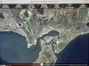
5. 80/20 split screen with FPV and google maps view, the so called "Navigation Map" mode. Option to go full screen, full map, radar map.
6. Identifies on the screen's top left corner, what flight mode you're in from NAZA. Whether it's GPS, ATTI, Fail Safe or whatever else you set your S1 switch for.
7. WiFi wand, helps you to orient the transmitter and antenna for your strongest signal.
8. Auto Booster, indicates FPV Booster activated automatically upon turning on motor with Normal or Smart booster options.
9. Vertical Speed Indicator.
10. Pilot/Home Distance displays "Exceeding Pilot/Home Distance message when Home/Pilot distance exceeds the limit you set.
All in all, it is a very feature rich suite, but not cumbersome. Just as easy to use as the Vision app, and enough similarities between the two to make the transition a lot easier.