DJI Phantom 4 Pro & 2 huge military planes close fly by

Joined
Aug 14, 2016
Messages
1,075
Reaction score
169
Age
38
To view this content we will need your consent to set third party cookies.
For more detailed information, see our cookies page.

First flight today with my P4P. Around the 2:50 mark two huge low flying military planes come out of nowhere.

Sent from my SM-T710 using PhantomPilots mobile app
 
why did you decide to fly backwards on the way back? Did you hear them coming before you saw them? Either way good job seeing and avoiding those two aircraft.
 
Good job seeing them and descending. Where is this -- I'm thinking socal and if so you may have been in one of the restricted special use airspace zones that occupy a huge portion of southern and central California.

Take a look here and find the spot you were flying.

http://knowbeforeyoufly.org/air-space-map/

Also, in case you do not already have it download the B4UFLY app for iOS and Android.

Again, good eyes and appropriate response -- I bet they never saw you...


Brian
 
why did you decide to fly backwards on the way back? Did you hear them coming before you saw them? Either way good job seeing and avoiding those two aircraft.
No I didn't hear anything. I'm not really sure why I flew backwards like that. I was originally planning on flying to that Grey hill and hovering over it looking down while I ascended to 400ft but I received a extreme wind velocity warning fly with caution notification so I started coming back

Sent from my SM-T710 using PhantomPilots mobile app
 
Good job seeing them and descending. Where is this -- I'm thinking socal and if so you may have been in one of the restricted special use airspace zones that occupy a huge portion of southern and central California.

Take a look here and find the spot you were flying.

http://knowbeforeyoufly.org/air-space-map/

Also, in case you do not already have it download the B4UFLY app for iOS and Android.

Again, good eyes and appropriate response -- I bet they never saw you...


Brian
I was looking at my tablet fpv and noticed what I thought was birds at first. When I realized they were huge planes I pushed down on the stick as far as it would go! Scared me. Heart was pounding. They were so loud flying over me

Sent from my SM-T710 using PhantomPilots mobile app
 
I was looking at my tablet fpv and noticed what I thought was birds at first. When I realized they were huge planes I pushed down on the stick as far as it would go! Scared me. Heart was pounding. They were so loud flying over me

Sent from my SM-T710 using PhantomPilots mobile app

Yeah, I can imagine a change of underwear might have been needed as well! :eek:


Brian
 
A few people in my Facebook group checked for me and they confirmed I was not

KingDad1985, do yourself a favor and download the B4UFLY app as well as the Airmap app so YOU can check before flight. It's my guess you were in a restricted place. You must not rely on someone from Facebook.

http://knowbeforeyoufly.org/air-space-map/

That said, I'll repeat that you did a **** fine job seeing and reacting to the AC.


Brian
 
  • Like
Reactions: cr6
KingDad1985, do yourself a favor and download the B4UFLY app as well as the Airmap app so YOU can check before flight. It's my guess you were in a restricted place. You must not rely on someone from Facebook.

U.S. Air Space Map | Know Before You Fly

That said, I'll repeat that you did a **** fine job seeing and reacting to the AC.


Brian

Good advice. Another thing you can do is look on Skyvector.com and refer to the sectional for your area. Sectionals look intimidating at first, but there are a number of YouTube videos on how to interpret them.
 
Good advice. Another thing you can do is look on Skyvector.com and refer to the sectional for your area. Sectionals look intimidating at first, but there are a number of YouTube videos on how to interpret them.

Yeah, I'm going to have to wrap my head around the sectional charts at some point as I do plan to get the remote pilot certificate and I believe you either need or greatly benefit from knowing how to read and follow a sectional.


Brian
 
KingDad1985, do yourself a favor and download the B4UFLY app as well as the Airmap app so YOU can check before flight. It's my guess you were in a restricted place. You must not rely on someone from Facebook.

U.S. Air Space Map | Know Before You Fly

That said, I'll repeat that you did a **** fine job seeing and reacting to the AC.


Brian
I understand and I posted the coordinates. And someone did come back and say I was flying in a "zone" come to find out he was in the wrong area and took back his first claims.
 
Does anyone think my YouTube title is misleading? Or will cause harm to the drone community?

I don't think so, but it would be wise to be able to address the question of whether or not this was a restricted airspace area or not. If it is then you may wish to pull the video OR you may wish to post a comment about learning a lesson about knowing how to confirm the place is OK. I have a video that details a crash I had back in April but I used the video as something of a learning thing.

To view this content we will need your consent to set third party cookies.
For more detailed information, see our cookies page.

If you're not sure then it's probably best to pull the video -- you can always repost.


Brian
 
  • Like
Reactions: Schnoidz
Good advice. Another thing you can do is look on Skyvector.com and refer to the sectional for your area. Sectionals look intimidating at first, but there are a number of YouTube videos on how to interpret them.
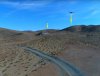
Here you go. I'm pretty sure this is where I was
 
That looks to be an OK location. The AC appeared to be less than 500AGL and definitely less than 1000AGL so they looked to have been hot rodding and an area they should not have. The thing is ... a huge portion of California and neighboring Neveda have restricted airspace owing to the USAF and Navy flight test/practice areas. So to with Utah.

But, download those apps so YOU know the next time before you head out.

Following up on you question about your video ... if the location you detailed is correct you may wish to make a comment about military AC, operating outside of the restricted airspace, flying below there minimums.


Brian
 
You're good to go as long as you were below 700' AGL. The little plus in the image below is roughly where you were. The thick magenta line indicates class E airspace beginning at 700 AGL.

30507833904_704a448f5f_b.jpg
 
Does anyone think my YouTube title is misleading? Or will cause harm to the drone community?
Yes ... it's misleading, nothing was close to hitting your Phantom.
But it will probably have no effect on anything.
It can be hard to accurately judge height of an aircraft.
Those planes were big and noisy but they were well above your level.
Look how high they are above the hills out to the right.
And your Phantom is lower than those hills.
You had several hundreds of feet vertical separation and probably more horizontal as well..
 

Attachments

  • Clearance.jpg
    Clearance.jpg
    319.8 KB · Views: 568
Glad you finally got your p4 pro KingDad1985 and what an eventful flight to begin with! [emoji33]

Great analysis there Meta you are probably right there was a fair bit of room.. but I would have needed a new pair of underwear afterwards too


Sent from my iPhone using PhantomPilots
 

Recent Posts

Members online

No members online now.

Forum statistics

Threads
143,066
Messages
1,467,352
Members
104,933
Latest member
mactechnic