I appreciate your kind words, too. I'm not trying to break anybody's chops, I just do not want to see any of us get in trouble, especially since some metropolitan Airspace can be quite complicated to decipher. I've been at it 40 years, so I have a pretty good handle on it. If you have any particular place you are interested in flying, shoot me a link or the coordinates and I will dope it out for you, just to be sure.
Actually, the cool thing about learning the airspace is, it often allows you to fly in places that appear to the unflyable at first glance.
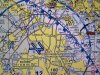
I use
www.VFRMAP.com
It lets you toggle between a Google Earth view, so you can pinpoint your intended flying place on a "real" map, and then toggle to the FAA Sectional to get the airspace information. I don't trust B4UFly or DJI's software. Use only an FAA Sectional or TCA, (Terminal Control Area), map.
Nice video, man. I mean it. Inspiring.


")