September 25 is a great time to see the blue berry bushes change scarlet red. The valley was in the low 70's and Dolly Sods was in the low 50's. Where the air masses met, it formed unique stream of clouds that only formed at the cliffs edge. Before man logged this area, it had 23 feet in diameter red spruce trees. The moss was up to 20 feet thick. Once the trees were cut, the moss dried up and caught fire from the shay locomotives exhaust. What was left was fields full of boulders and a wild harsh environment. Oh, the stories I could tell. There is still quiet beauty here.
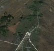
The influx of people at this time of year was a little unnerving. Traffic was crazy. I use to have this place to myself. The cliff area and west is owned by Nature Conservancy. The road and east is right of way and private land. West of the road is Dolly Sods Wilderness. Dolly sods Wilderness is trying to buy a much greater area, which would make it illegal to fly in this area in the future.
SHOW LESS