For exsample fly litchi program pre-programmed waypoint on the fly, the camera functions always take place at the waypoint.
Is there a program where the images are taken with predetermined settings throughout the route/line, such as overlap% or time interval?
Such as pix4d Capture in the selected area, but the description should take place on the line / route.
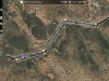
It would be good to check electric lines or other long lines....
I've been looking but I have not found this feature for any program.
ve5ku/P4P
Is there a program where the images are taken with predetermined settings throughout the route/line, such as overlap% or time interval?
Such as pix4d Capture in the selected area, but the description should take place on the line / route.
It would be good to check electric lines or other long lines....
I've been looking but I have not found this feature for any program.
ve5ku/P4P
")