FAA and their 400' elevation limit

BVC

Joined
Feb 21, 2015
Messages
533
Reaction score
186
Location
Sacramento, CA / Dener, CO
So today's flight made me wonder how they will enforce the 400' rule.

When you take off from your location it's considered ground 0. Assuming you're in a flat area then your 400ft limit should be easy to maintain.

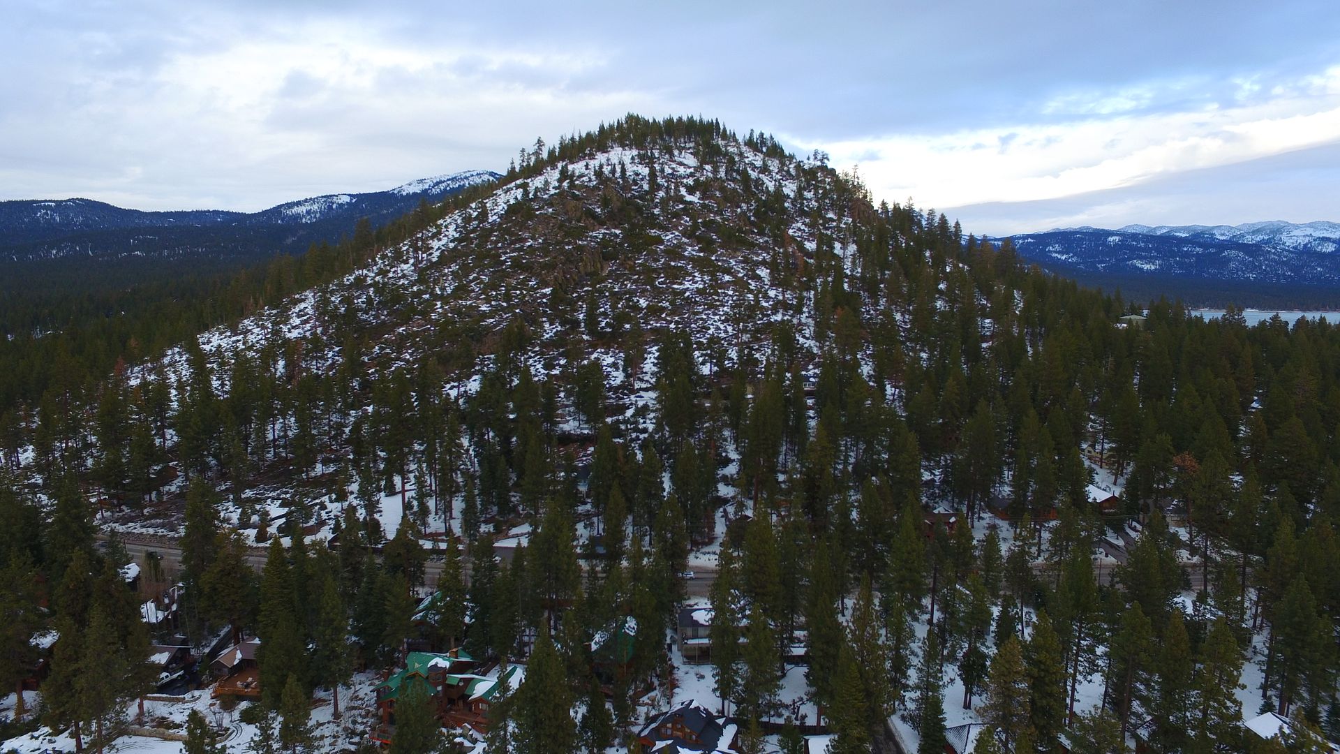
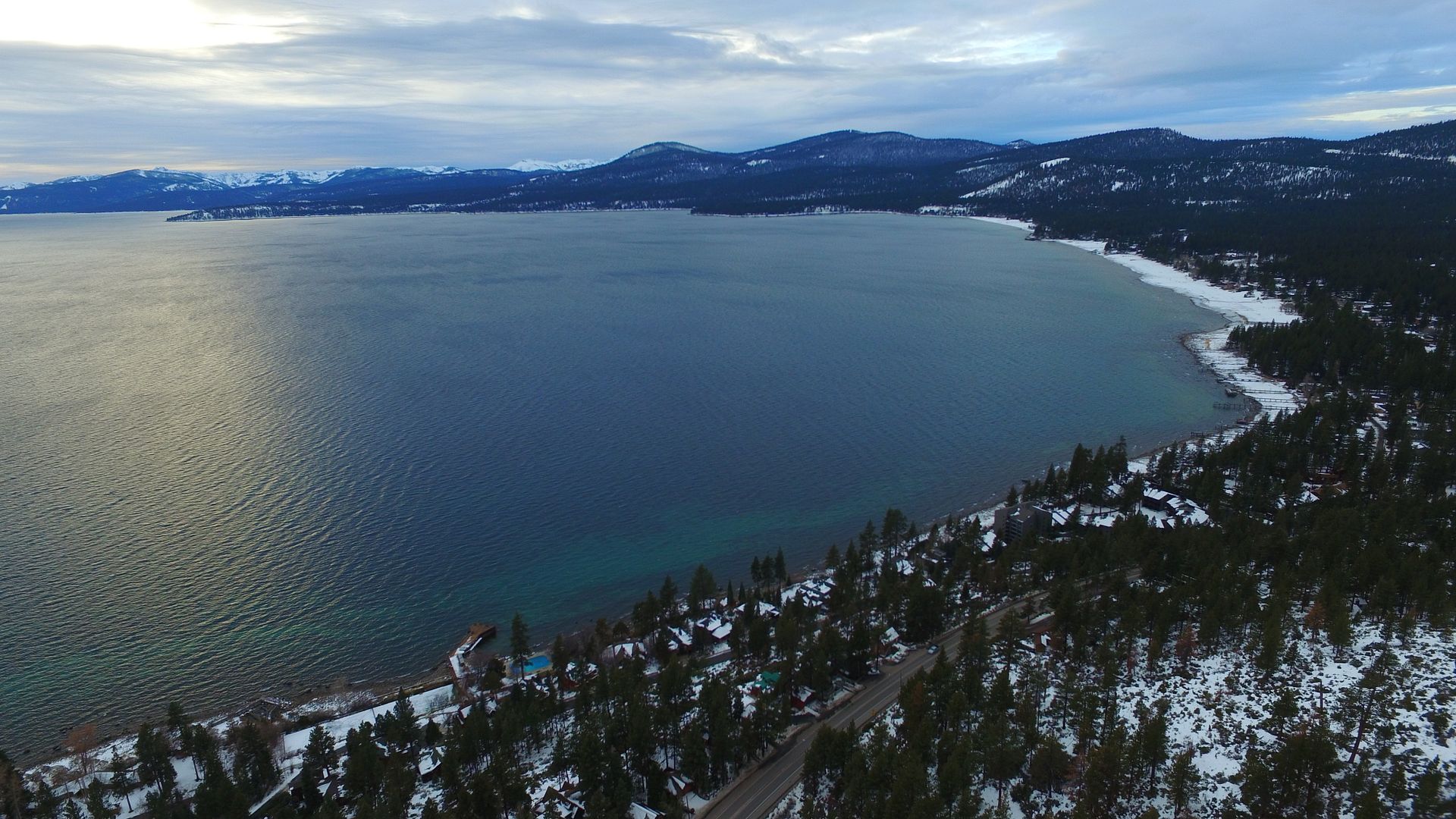
How about if you climb a mountain? I flew up the side of a mountain behind the cabin. I was fairly close to the ground at the peak but my display shows an elevation of 980'. I was slightly above treeline at the peak so I was 100-200' above the peak of the mountain.

Something to watch and I'm curious to see how the FAA will enforce this type of situation..


  • Like
Reactions: ashtonhess
Recommendations are for 400' AGL. Above ground level
 
Recommendations are for 400' AGL. Above ground level

Well yeah. But if I go up to the mountain and climb it in elevation up to 980' from my home, take my shots then fly 1000 ft back to my home at "ground zero"..

My flight log shows a max altitude of 980' when in reality I was maybe 300' away from the mountain and climbed the side up to 980' from my point.
 
Yup. Above ground level refers to above the ground level directly below the aircraft. So if you live on top of a hill with a 400' valley 100 feet off your launch pad, the aircraft is already 400 AGL once it launches over the valley even if you don't increase the elevation of the bird.
There is a pretty cool app that will give you altitude information on the basis of topo maps. It's called elevation chart for iOS.
 
Thats the good thing about having the flight recorded, if challenged you can prove where you were flying. But I suppose that can also work against you ......
 
So you were the one flying over us at Cal Neva today and down Brockway Rd. Don't you know this is a restrictless zone... lol. Traffic was wild today... :D
 
The problem is that the Phantom can only figure out relative altitude above a fixed reference (the Home Point). Works fine if the ground is flat, in the real world (or even your cartoon world) not so much.

We need a tiny little X-band altimeter that can show real time altitude over ground.
 
I was playing with the max height setting and thinking about mountains/cliffs etc, just like you diagrammed (which btw was one of the best things I've seen today) . Sure, you may be above 400' AGL, but there is going to be nothing there to interfere with, except perhaps birds.

Except the airport bit, all the FAA stuff seems to mostly be guidelines for doing things safely. Along this lines of "Look...we don't want to have to crack the the whip and get all enforcement. Follow these guidelines and pay attention and you should stay out of trouble and never have to see us, and NTSB won't be talking to you."

Like Marknmd said - if you plan ahead and are responsible, you should know you're okay.

Oh...and nice shots!
 
I understand the 400ft rule but it some cases it makes no sense. I'm out in the middle of no where in a valley with a 1000ft ridge in front of me I want to film from the valley to the top. I plan to fly tree top say 80ft high, and follow the contour of the ridge up. If I follow the 400ft rule I'll get less than halfway up.........
 
The guidelines stem from AC 91-57A about model aircraft http://www.faa.gov/documentLibrary/media/Advisory_Circular/AC_91-57A.pdf
Model aircraft operators should follow best practices including limiting operations to 400 feet above ground level (AGL)

In your example, you wouldn't be more than 80ft AGL. The problem is in the Phantom - it doesn't know AGL - it just knows where it started at and the delta, which is why you can go in and override the max height, and acknowledge the pop-up.
 
  • Like
Reactions: FASTFJR
I understand the 400ft rule but it some cases it makes no sense. I'm out in the middle of no where in a valley with a 1000ft ridge in front of me I want to film from the valley to the top. I plan to fly tree top say 80ft high, and follow the contour of the ridge up. If I follow the 400ft rule I'll get less than halfway up.........
I fly over the valleys all the time and have no idea how high I am over the valley but I'm adhering to the AGL 400 ft rule.

Just have to be aware of where you are in the Valleys.
 
Cool video gringorio, I'm assuming you had good LOS the whole time? How was the LVF? Pretty cool.
 

Recent Posts

Members online

No members online now.

Forum statistics

Threads
143,094
Messages
1,467,590
Members
104,977
Latest member
wkflysaphan4