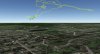
After uploading log files to healthdrones.com, and downloading the google earth stuff, it shows me taking off a couple hundred feet in the air rather than on the ground. This is consistent with all logs lately. Any ideas? I attached an example here.
This site uses cookies to help personalise content, tailor your experience and to keep you logged in if you register.
By continuing to use this site, you are consenting to our use of cookies.